
Rehoboth Tours & Safaris
Rehoboth Tours and Safaris is a Zimbabwe-registered company with offices in the tourist capital of Victoria Falls, Zimbabwe. The Company specializes in providing services such as Mid-budget to Luxury Safari lodges, Budget Camping, Hwange Safari trips, Chobe full-day trips, Hotel Reservations, packaged tours, Activities, and Airport transfers in Zimbabwe, Botswana, Zambia, South Africa attractions, and Namibia.
TOP
SOUTH AFRICA
DESTINATIONS
EVERYDAY IS A HOLIDAY.
SOUTH AFRICA ATTRACTIONS.
Interesting Facts About South Africa
- South Africa is the largest country in Southern Africa and the 25th-largest country in the world
- with close to 56 million people, is the world’s 24th-most populous nation
- About 80 percent of South Africans are of Sub-Saharan African ancestry.
- South Africa has the seventh-highest per capita income in Africa.
- Its economy is the second-largest in Africa.
Cape Town also known as the Mother City, is South Africa’s oldest city. It serves as the country’s legislative capital, being the seat of the South African Parliament. It is the country’s second-largest city (after Johannesburg) and the largest in the Western Cape. The city is part of the City of Cape Town metropolitan municipality.
The city is known for its harbour, its natural setting in the Cape Floristic Region, and landmarks such as Table Mountain and Cape Point. In 2014, Cape Town was named the best place in the world to visit by The New York Times and similarly by The Daily Telegraph in 2016.
Located on the shore of Table Bay, the City Bowl area of Cape Town is the oldest urban area in the Western Cape, with a significant cultural heritage. It was founded by the Dutch East India Company (VOC) as a supply station for Dutch ships sailing to East Africa, India, and the Far East. Jan van Riebeeck’s arrival on 6 April 1652 established the VOC Cape Colony, the first permanent European settlement in South Africa. Cape Town outgrew its original purpose as the first European outpost at the Castle of Good Hope, becoming the economic and cultural hub of the Cape Colony. Until the Witwatersrand Gold Rush and the development of Johannesburg, Cape Town was the largest city in southern Africa.
The city has a long coastline on the Atlantic Ocean, which includes False Bay, and extends to the Hottentots Holland mountains to the east. The Table Mountain National Park is within the city boundaries and there are several other nature reserves and marine-protected areas within, and adjacent to, the city, protecting the diverse terrestrial and marine natural environment.
History
Main articles: History of Cape Town and Timeline of Cape Town
Early period
Portuguese explorer Bartolomeu Dias planting the cross at Cape Point, 1488.
The earliest known remnants of human occupation in the region were found at Peers Cave in Fish Hoek and have been dated to between 15,000 and 12,000 years old.[14]
Little is known of the history of the region’s first residents, since there is no written history from the area before it was first mentioned by Portuguese explorer Bartolomeu Dias. Dias, the first European to reach the area, arrived in 1488 and named it “Cape of Storms” (Cabo das Tormentas). It was later renamed by John II of Portugal as “Cape of Good Hope” (Cabo da Boa Esperança) because of the great optimism engendered by the opening of a sea route to the Indian subcontinent and East Indies.
In 1497, Portuguese explorer Vasco da Gama recorded a sighting of the Cape of Good Hope.
In 1510, at the Battle of Salt River, the Portuguese admiral Francisco de Almeida and sixty-four of his men were killed and his party was defeated by the!Uriǁ’aekua (“Goringhaiqua” in Dutch approximate spelling) using specially trained cattle. The!Uriǁ’aekua were one of the so-called Khoekhoe clans who inhabited the area.
In the late 16th century French, Danish, Dutch and English, but mainly Portuguese, ships regularly continued to stop over in Table Bay en route to the Indies. They traded tobacco, copper, and iron with the Khoekhoe clans of the region in exchange for fresh meat and other essential travelling provisions.
Dutch period
A diorama of Cape Town as it would have appeared in 1800 at the end of Dutch rule by the VOC.
In 1652, Jan van Riebeeck and other employees of the United East India Company (Dutch: Verenigde Oost-indische Compagnie, VOC) were sent to the Cape Colony to establish a way-station for ships travelling to the Dutch East Indies, and the Fort de Goede Hoop (later replaced by the Castle of Good Hope). The settlement grew slowly during this period, as it was hard to find adequate labour. This labour shortage prompted the local authorities to import enslaved people from Indonesia and Madagascar. Many of these people are ancestors of modern-day Cape Coloured communities.
Under Van Riebeeck and his successors, as VOC commanders and later governors at the Cape, a wide range of agricultural plants were introduced to the Cape. Some of these, including grapes, cereals, ground nuts, potatoes, apples and citrus, had a large and lasting influence on the societies and economies of the region.
British period
Adderley Street in 1897 was an important commercial hub in Cape Town at a time when the city was the most important centre of economic activity in the Southern Africa region.
With the Dutch Republic being transformed into Revolutionary France’s vassal Batavian Republic, Great Britain moved to take control of Dutch colonies, including the colonial possessions of the VOC.
Britain captured Cape Town in 1795, but it was returned to the Dutch by treaty in 1803. British forces occupied the Cape again in 1806 following the Battle of Blaauwberg when the successor state to the Batavian Republic, the Kingdom of Holland, allied with France during the Napoleonic Wars.
In the Anglo-Dutch Treaty of 1814, Cape Town was permanently ceded to the United Kingdom. It became the capital of the newly formed Cape Colony, whose territory expanded very substantially through the 1800s. With expansion came calls for greater independence from the UK, with the Cape attaining its own parliament (1854) and a locally accountable Prime Minister (1872). Suffrage was established according to the non-racial Cape Qualified Franchise.
During the 1850s and 1860s, additional plant species were introduced from Australia by the British authorities. Notably, rooikrans was introduced to stabilise the sand of the Cape Flats to allow for a road connecting the peninsula with the rest of the African continent and eucalyptus was used to drain marshes.
In 1859 the first railway line was built by the Cape Government Railways and a system of railways rapidly expanded in the 1870s. The discovery of diamonds in Griqualand West in 1867, and the Witwatersrand Gold Rush in 1886, prompted a flood of immigration into South Africa. In 1895 the city’s first public power station, the Graaff Electric Lighting Works, was opened.
Conflicts between the Boer republics in the interior and the British colonial government resulted in the Second Boer War of 1899–1902. Britain’s victory in this war led to the formation of a united South Africa. From 1891 to 1901, the city’s population more than doubled from 67,000 to 171,000.
As the 19th century came to an end, the economic and political dominance of Cape Town in the Southern Africa region during the 19th century started to give way to the dominance of Johannesburg and Pretoria in the 20th century.
South African period
In 1910, Britain established the Union of South Africa, which unified the Cape Colony with the two defeated Boer Republics and the British colony of Natal. Cape Town became the legislative capital of the Union, and later of the Republic of South Africa.
By the time of the 1936 census, Johannesburg had overtaken Cape Town as the largest city in the country.
Apartheid-era
In 1945 the expansion of the Cape Town foreshore adding an additional 194 ha (480 acres) to the city bowl area was completed. Visible in this photograph is the large area of empty land between the City Centre and the newly constructed harbour.
Prior to the mid-twentieth century, Cape Town was one of the most racially integrated cities in South Africa. In the 1948 national elections, the National Party won on a platform of apartheid (racial segregation) under the slogan of “swart gevaar” (Afrikaans for “black danger”). This led to the erosion and eventual abolition of the Cape’s multiracial franchise.
In 1950, the apartheid government first introduced the Group Areas Act, which classified and segregated urban areas according to race. Formerly multi-racial suburbs of Cape Town were either purged of residents deemed unlawful by apartheid legislation or demolished. The most infamous example of this in Cape Town was the suburb of District Six. After it was declared a whites-only area in 1965, all housing there was demolished and over 60,000 residents were forcibly removed. Many of these residents were relocated to the Cape Flats.
The earliest of the Cape Flats forced removals saw the expulsion of Black South Africans to the Langa township in line with the 1923 Native Urban Areas Act. Langa is the oldest township in Cape Town and the scene of much resistance against apartheid. Its origins go back to the 19th century.
Under apartheid, the Cape was considered a “Coloured labour preference area”, to the exclusion of “Bantus”, i.e. Black Africans. The implementation of this policy was widely opposed by trade unions, civil society and opposition parties. It is notable that this policy was not advocated for by any Coloured political group, and its implementation was a unilateral decision by the apartheid government. During the student-led Soweto Uprising of June 1976, school students from Langa, Gugulethu and Nyanga in Cape Town reacted to the news of the protests against Bantu Education by organising gatherings and marches of their own. A number of school buildings were burnt down and the protest action was met with forceful resistance from the police.
Cape Town has been home to many leaders of the anti-apartheid movement. In Table Bay, 10 km (6 mi) from the city is Robben Island. This penitentiary island was the site of a maximum-security prison where many famous apartheid-era political prisoners served long prison sentences. Famous prisoners include activist, lawyer and future president Nelson Mandela who served 18 of his 27 years of imprisonment on the island, as well as two other future presidents, Kgalema Motlanthe and Jacob Zuma.
In one of the most famous moments marking the end of apartheid, Nelson Mandela made his first public speech since his imprisonment, from the balcony of Cape Town City Hall, hours after being released on 11 February 1990. His speech heralded the beginning of a new era for the country. The first democratic election, was held four years later, on 27 April 1994.
Nobel Square in the Victoria & Alfred Waterfront features statues of South Africa’s four Nobel Peace Prize winners: Albert Luthuli, Desmond Tutu, F. W. de Klerk and Nelson Mandela.
Post-apartheid era
Cape Town faced a severe water shortage from 2015 to 2018.
Since the 2010s, Cape Town and the wider Western Cape province have seen the rise of a small secessionist movement. Support for parties “which have formally adopted Cape independence” was around 5% in the 2021 municipal elections.
Geography and the natural environment
Devil’s Peak, Table Mountain and Lion’s Head
Cape Town is located at latitude 33.55° S (approximately the same as Sydney and Buenos Aires and equivalent to Casablanca and Los Angeles in the northern hemisphere) and longitude 18.25° E.
Table Mountain, with its near vertical cliffs and flat-topped summit over 1,000 m (3,300 ft) high, and with Devil’s Peak and Lion’s Head on either side, together form a dramatic mountainous backdrop enclosing the central area of Cape Town, the so-called City Bowl. A thin strip of cloud, known colloquially as the “tablecloth” (“Karos” in Afrikaans), sometimes forms on top of the mountain. To the immediate south of the city, the Cape Peninsula is a scenic mountainous spine jutting 40 km (25 mi) southward into the Atlantic Ocean and terminating at Cape Point.
There are over 70 peaks above 300 m (980 ft) within Cape Town’s official city limits. Many of the city’s suburbs lie on the large plain called the Cape Flats, which extends over 50 km (30 mi) to the east and joins the peninsula to the mainland. The Cape Town region is characterised by an extensive coastline, rugged mountain ranges, coastal plains and inland valleys.
Extent
The extent of Cape Town has varied considerably over time. It originated as a small settlement at the foot of Table Mountain and has grown beyond its city limits as a metropolitan area to encompass the entire Cape Peninsula to the south, the Cape Flats, the Helderberg basin and part of the Steenbras catchment area to the east, and the Tygerberg hills, Blouberg and other areas to the north. Robben Island in Table Bay is also part of Cape Town. It is bounded by the Atlantic Ocean to the west, and False Bay to the south. To the north and east, the extent is demarcated by boundaries of neighbouring municipalities within the Western Cape province.
The Cape Peninsula is 52 km (30 mi) long from Mouille Point in the north to Cape Point in the south,[36] with an area of about 470 km2 (180 sq mi), and it displays more topographical variety than other similar sized areas in southern Africa, and consequently spectacular scenery. There are diverse low-nutrient soils, large rocky outcrops, scree slopes, a mainly rocky coastline with embayed beaches, and considerable local variation in climatic conditions. The sedimentary rocks of the Cape Supergroup, of which parts of the Graafwater and Peninsula Formations remain, were uplifted between 280 and 21S million years ago and were largely eroded away during the Mesozoic. The region was geologically stable during the Tertiary, which has led to slow denudation of the durable sandstones. Erosion rate and drainage have been influenced by fault lines and fractures, leaving remnant steep-sided massifs like Table Mountain surrounded by flatter slopes of deposits of the eroded material overlaying the older rocks,
There are two internationally notable landmarks, Table Mountain and Cape Point, at opposite ends of the Peninsula Mountain Chain, with the Cape Flats and False Bay to the east and the Atlantic Ocean to the west. The landscape is dominated by sandstone plateaux and ridges, which generally drop steeply at their margins to the surrounding debris slopes, interrupted by a major gap at the Fish Hoek–Noordhoek valley. In the south, much of the area is a low sandstone plateau with sand dunes. The maximum altitude is 1113 m on Table Mountain. The Cape Flats (Afrikaans: Kaapse Vlakte) is a flat, low-lying, sandy area, area to the east of the Cape Peninsula, and west of the Helderberg much of which was wetland and dunes within recent history. To the north are the Tygerberg Hills and the Stellenbosch district.
The Helderberg area of Cape Town, previously known as the “Hottentots-Holland” area, is mostly residential, but also a wine-producing area east of the Cape Flats, west of the Hottentots Holland Mountain range and south of the Helderberg mountain, from which it gets its current name. The Helderberg consists of the previous municipalities of Somerset West, Strand, Gordons Bay and a few other towns. Industry and commerce are largely in service of the area. After the Cape Peninsula, Helderberg is the next most mountainous part of Cape Town, bordered to the north and east by the highest peaks in the region along the watershed of the Helderberg and Hottentots Holland Mountains, which are part of the Cape Fold Belt with Cape Supergroup strata on a basement of Tygerberg Formation rocks intruded by part of the Stellenbosch granite pluton. The region includes the entire catchment of the Lourens and Sir Lowry’s rivers, separated by the Schapenberg hill, and a small part of the catchment of the Eerste River to the west. The Helderberg is ecologically highly diverse, rivalling the Cape Peninsula, and has its own endemic ecoregions and several conservation areas.
To the east of the Hottentots Holland mountains is the valley of the Steenbras River, in which the Steenbras Dam was built as a water supply for Cape Town. The dam has been supplemented by several other dams around the western Cape, some of them considerably larger. This is almost entirely a conservation area, of high biodiversity. Tygerberg Hills, Blouberg Hill, and Durbanville are a few of the suburbs that make up the northern areas of Cape Town. In current popular culture, these areas are often referred to as being beyond the “boerewors curtain,” a play on the term “iron curtain.”
UNESCO declared Robben Island in the Western Cape a World Heritage Site in 1999. Robben Island is located in Table Bay, some 6 km (3.7 mi) west of Bloubergstrand in Cape Town, and stands some 30m above sea level. Robben Island has been used as a prison where people were isolated, banished, and exiled for nearly 400 years. It was also used as a leper colony, a post office, a grazing ground, a mental hospital, and an outpost.
Kruger National Park is a South African National Park and one of the largest game reserves in Africa. It covers an area of 19,623 km2 in the provinces of Limpopo and Mpumalanga in north-eastern South Africa and extends 360 km (220 mi) from north to south and 65 km (40 mi) from east to west. The administrative headquarters are in Skukuza. Areas of the park were first protected by the government of the South African Republic in 1898, and it became South Africa’s first national park in 1926.
To the west and south of the Kruger National Park are the two South African provinces of Limpopo and Mpumalanga, respectively. To the north is Zimbabwe and to the east is Mozambique. It is now part of the Great Limpopo Transfrontier Park, a peace park that links Kruger National Park with the Gonarezhou National Park in Zimbabwe, and with the Limpopo National Park in Mozambique.
The park is part of the Kruger to Canyons Biosphere, an area designated by the United Nations Educational, Scientific and Cultural Organization (UNESCO) as an International Man and Biosphere Reserve.
The park has nine main gates allowing entrance to the different camps.
History
Main article: History of the Kruger National Park
Pre-reserve (before 1898)
Over 420 recorded archaeological sites in Kruger Park attest to its occupation before modern times. Most sites however had relatively short occupation periods, as the presence of predators and the tsetse fly limited cattle husbandry. At Masorini Hill, the H9 route, iron smelting was practiced up to the Mfecane era. The reconstructed Thulamela on a hilltop south of the Levuvhu River was occupied from the 13th to 16th centuries and had links with traders from the African east coast.
Before the Second Anglo-Boer War, the area now covered by the park was a remote section of the eastern South African Republic’s last wild frontier. Paul Kruger, President of the South African Republic at the time, proclaimed the area, which was inhabited by the Tsonga people, a sanctuary for the protection of its wildlife. James Stevenson Hamilton noted many kraals along the Sabi River and also further north beyond the Letaba River although the north was sparsely populated compared to the south. Many of the local natives were employed by railway companies for the construction of rail connections, notably between Pretoria (now in South Africa) and Lorenço Marques (now Maputo, Mozambique) during the end of the 19th century. Abel Chapman, one of the hunters who noted that the area was overhunted by the end of the 19th century, brought this fact to wider attention.
Sabi Game Reserve (1898–1926)
In 1895, Jakob Louis van Wyk introduced in the Volksraad of the South African Republic a motion to create the game reserve. The area proposed extended from the Crocodile River to the Sabi River in the north. That motion, introduced together with another Volksraad member by the name of R. K. Loveday, and accepted for discussion in September 1895 by a majority of one vote, resulted in the proclamation by Paul Kruger, on 26 March 1898, of a “Government Wildlife Park.” This park would later be known as the Sabi Game Reserve.
The park was initially created to control hunting and to protect the diminished number of animals in the park.
James Stevenson-Hamilton became the first warden of the reserve in 1902. The reserve was located in the southern one-third of the modern park. Singwitsi Reserve, named after the Shingwedzi River and now in northern Kruger National Park, was proclaimed in 1903. During the following decades all the native tribes were removed from the reserve and during the 1960s the last were removed at Makuleke in the Pafuri triangle. In 1926, Sabie Game Reserve, the adjacent Shingwedzi Game Reserve, and farms were combined to create Kruger National Park.
During 1923, the first large groups of tourists started visiting the Sabie Game Reserve, but only as part of the South African Railways’ popular “Round in Nine” tours. The tourist trains used the Selati railway line between Komatipoort on the Mozambican border and Tzaneen in Limpopo Province. The tour included an overnight stop at Sabie Bridge (now Skukuza) and a short walk, escorted by armed rangers, into the bush. It soon became a highlight of the tour and it gave valuable support for the campaign to proclaim the Sabie Game Reserve as a national park.
Kruger National Park (1926–1946)
After the proclamation of the Kruger National Park in 1918, the first three tourist cars entered the park in 1927, jumping to 180 cars in 1928 and 850 cars in 1929.
Warden James Stevenson-Hamilton retired on 30 April 1946, after 44 years as warden of the Kruger Park and its predecessor, the Sabi Sabi Game Reserve.
1946–1994
Plaque in the park. Now and then people do get killed; however, this is extremely rare.
Stevenson-Hamilton was replaced as warden by Colonel J. A. B. Sandenbergh of the South African Air Force. In 1959, work commenced to completely fence the park’s boundaries. Work started on the southern boundary along the Crocodile River and in 1960 the western and northern boundaries were fenced, followed by the eastern boundary with Mozambique. The purpose of the fence was to curb the spread of diseases, facilitate border patrolling and inhibit the movement of poachers.
The Makuleke area in the northern part of the park was forcibly taken from the Makuleke people by the government in 1969 and about 1500 of them was relocated to land to the south so that their original tribal areas could be integrated into the greater Kruger National Park.
1994–present
In 1996 the Makuleke tribe submitted a land claim for 19,842 hectares (198.42 km2), namely the Pafuri or Makuleke region in the northernmost part of the park. The land was given back to the Makuleke people, however, they chose not to resettle on the land but to engage with the private sector to invest in tourism. This resulted in the building of several game lodges from which they earn royalties.
In the late 1990s, the fences between the Kruger Park and Klaserie Game Reserve, Olifants Game Reserve, and Balule Game Reserve were dropped and incorporated into the Greater Kruger Park with 400,000 hectares added to the Reserve. In 2002, Kruger National Park, Gonarezhou National Park in Zimbabwe, and Limpopo National Park in Mozambique were incorporated into a peace park, the Great Limpopo Transfrontier Park.
In 2009, SANParks envisaged a four-star hotel northeast of Malelane on the bank of the Crocodile River, as part of a survival strategy to make the park less dependent on state subsidies. Eventually, Radisson Blu was mandated to operate a 104-room safari resort starting in 2019, which promises a smaller ecological footprint than that of prior, existing camps. The three-star, 128-room Skukuza Safari Lodge, to be completed by late 2018, was necessitated by the adjacent Nombolo Mdhluli conference center, opened in 2011, which draws guests arriving by charter flights or in tour busses. Former head of the park Salomon Joubert warned that these developments threaten the character, ethos, and original objectives of the park, but the minister of environmental affairs, Edna Molewa, deemed the development of 0.3% of the park as acceptable. The park was temporarily closed due to the COVID-19 pandemic on 25 March 2020. It was reopened on 8 June 2020.
The Garden Route National Park is a national park in the Garden Route region of the Western Cape and Eastern Cape provinces in South Africa. It is a coastal reserve well known for its indigenous forests, dramatic coastline, and the Otter Trail. It was established on 6 March 2009 by amalgamating the existing Tsitsikamma and Wilderness National Parks, the Knysna National Lake Area, and various other areas of state-owned land.
The park covers about 1,210 km2 (470 sq mi) of land; of this, about 685 km2 (264 sq mi) was already part of the predecessor national parks. The park includes a continuous complex of approximately 605 km2 (234 sq mi) of indigenous forest.
The Garden Route National Park (Tsitsikamma, Knysna, and Wilderness Sections) has a pleasant, temperate climate; it is unique in Africa as the only area in which rainfall occurs throughout the year.
Sections
The Tsitsikamma section of the park covers an 80 kilometers (50 miles) long stretch of coastline with Nature’s Valley at the western end of the park. The section is known for its indigenous forests, dramatic coastline, and the Otter Trail. The main accommodation is at Storms River Mouth. Near the park is the Bloukrans Bridge, the world’s highest bridge bungee jump at 216 meters (709 ft).
Wilderness section
The Wilderness section is located around the seaside town of Wilderness, Western Cape between the larger towns of George, Sedgefield, and Knysna, in the Western Cape. It stretches from the Touw River mouth to the Swartvlei estuary and beyond, where it links with the Goukamma Nature Reserve, giving protection to five lakes and the Serpentine, which is the winding strip of water joining Island Lake to the Touw River at the Ebb and Flow Rest Camp. This section of the park protects three major zones of indigenous forest, four types of fynbos (wild shrubs), and various lakes and winding waterways. There are also a number of archaeologically significant sites.
Stellenbosch Museum is a cultural history museum in the center of Stellenbosch, South Africa. It was proclaimed a museum on 23 March 1962 and is a province-aided museum that receives support from the Government of the Western Cape. The museum includes four-period houses that depict the way people lived and the difference in architectural styles over the periods illustrated (the Village Museum). It also includes a historical powder magazine and a toy museum.
Schreuder House
The Schreuder House is the first-period house in the museum complex and is furnished according to period c. 1709. The house was built in August 1707 by Sebastian Schreuder, who was a German messenger of the court of the Dutch East India Company. It is a pioneer cottage with a thatched roof and clay floor. Because window glass had to be imported from Holland, the windows are made of linen or gauze stretched over a frame with beeswax to seal the cloth against the elements. During a hard downpour, the housewife simply closed the outside shutters; in fine weather, the catches were released, the whole frame was lifted out, and fresh air was let in. The house was declared a monument in 1974 and is currently listed as a Grade II Western Cape provincial heritage site.
Bletterman House
The Bleterman House in the museum complex depicts the period of c. 1789. The house was built by Hendrik Lodewyk Bletterman, Landdrost (Magistrate) of Stellenbosch from 1785–1795. This dwelling is a Cape Dutch H-shaped house and an example of a gabled house from the 18th century. The site on which Bletterman House is situated was purchased by Hendrik Lodewyk Bletterman in 1787. Since the Hertzog plan of 1817 shows a building on this site, it is assumed that Bletterman built the house sometime before that date. After his death in 1824, the house was sold to the Landdrost and Heemraden, and was converted into offices and a courtroom, becoming the “Stellenbosch Public Offices”. The outbuilding was renovated and equipped with 50 school benches and served as a school for slaves. The school was officially opened in September 1825, with Erasmus Smit as a teacher. There is no record that the main house was ever used as a residence after Bletterman’s death. The Stellenbosch Police used the buildings as their headquarters from about 1879–1969 when it was acquired by the Stellenbosch Museum.
Grosvenor House
The Grosvenor House is a mansion that depicts the period c. 1803 and is the ancestral home of the Neethling family. The site on which it stands was granted to Christiaan Ludolph Neethling in 1781, and a year later he had built a double-storey house on the property. Successive owners kept the house virtually unaltered. In 1872, Sir Christoffel J. Brand, the first speaker of the Cape House of Assembly, became the new owner. After his death in 1876, William Collins of Bath, England, bought the property and it remained in the possession of his wife until 1941. The Collins family named the building Grosvenor House and converted it into a guest house.
Grosvenor House was the building in which the Stellenbosch Museum was located at the time of its proclamation. The building has been restored to illustrate the period c. 1800–c. 1830 when Willem Herold and his family Willem Herold and his family. The house has been declared a provincial heritage site.
Individual items of furniture reflect the increasing influence of English taste on local furniture design after the second British occupation of the Cape in 1806 when Neoclassicism was in fashion. The interior doors have stinkwood frames and yellowwood panels. There are unusual shutters of the same wood and a heavy front door of solid teak. The facade of the house was designed in the classical style with fluted pilasters running up to support a wide cornice. The classicism is repeated in the treatment of the pedimented front door, which surrounds a plasterwork palm tree, the symbol on the Stellenbosch Church seal.
Bergh House
This Victorian house (now a provincial heritage site) was first owned by Christiaan Krynauw who is presumed to have erected a new T-shaped dwelling on the site. Olof Marthinus Bergh bought the property in 1836. He was born in Cape Town in 1792 and was Deputy-Sheriff of Stellenbosch.
An upper storey was added to the house during the second half of the 19th century. The house is furnished to reflect the interior of a typical middle-class Stellenbosch home during the period 1840 – 1880, more-or-less the time it was occupied by Bergh and his family. Heavy mahogany furniture in the prevailing English taste was very fashionable at the time and the Victorian penchant for clutter often made it difficult to move about in the drawing room. Wallpaper and family portraits are further indications of how sombre interior decoration was at the time – particularly after the Great Exhibition in 1851. The garden is laid out in the style of the period with roses and other shrubs that were popular during the mid-19th century.
Powder Magazine
In the turbulent last quarter of the eighteenth century, the Governor and the Political Council at Cape Town came to the conclusion that it was desirable to store ammunition at Stellenbosch. Stellenbosch was also allowed cannon and guns, and the gunpowder and ammunition necessary to ward off an enemy attack, and a suitable building for storing this material had to be constructed. The consent of the governing council of the Dutch East India Company (V.O.C.) in the Netherlands was duly applied for and received, and authority was given to build the arsenal or magazine. On 7 October 1776, the Landdrost called for tenders for erection of the building. That of Philip Hartog and Lambert Fick for 9000 guilders was accepted and on 5 May 1777, the building was completed.
Stellenbosch has always been a peaceful town and not once during its 300 years of existence have guns been fired as an act of war. The V.O.C. Kruithuis therefore soon lost its strategic military value and in less than seventy years became the site of the local Friday market. After serving as a market house for almost a century, it was restored by the Stellenbosch Municipality in 1936. The building was proclaimed a National Monument (now a provincial heritage site) on 10 May 1940, and in 1943, was opened to the public as a small Africana Museum. The museum did not exist for very long, and there were many years during which the building remained locked and inaccessible to the public. In 1971, the municipality agreed to allow the Stellenbosch Museum to take over the building for the display of its collection of firearms, cannons, military uniforms, and other objects.
The V.O.C. Kruithuis is unique in South Africa as it is the only remaining powder magazine in the country dating from the days of the Dutch East India Company, and it is a symbol of the town’s rich and varied architectural heritage.
The Drakensberg (Afrikaans: Drakensberge, Zulu: uKhahlambha, Sotho: Maluti) is the eastern portion of the Great Escarpment, which encloses the central Southern African plateau. The Great Escarpment reaches its greatest elevation – 2,000 to 3,482 meters (6,562 to 11,424 feet) within the border region of South Africa and Lesotho.
A map of South Africa shows the central plateau edged by the Great Escarpment and its relationship to the Cape Fold Mountains to the south. The portion of the Great Escarpment shown in red is known as the Drakensberg.
The Drakensberg escarpment stretches for more than 1,000 kilometers (600 miles) from the Eastern Cape Province in the South, then successively forms, in order from south to north, the border between Lesotho and the Eastern Cape and the border between Lesotho and KwaZulu-Natal Province. Thereafter it forms the border between KwaZulu-Natal and the Free State, and next as the border between KwaZulu-Natal and Mpumalanga Province. The escarpment winds north from there, through Mpumalanga, where it includes features such as the Blyde River Canyon, Three Rondavels, and God’s Window. It then extends farther north to Hoedspruit in southeastern Limpopo where it is known as ‘Klein Drakensberg’ by the Afrikaners. From Hoedspruit, it extends west to Tzaneen, also in Limpopo Province, where it is known as the Wolkberg Mountains and Iron Crown Mountain. At 2,200 m (7,200 ft) above sea level, the Wolkberg is the highest elevation in Limpopo. The escarpment extends west again and at Mokopane it is known as the Strydpoort Mountains.
Etymology
The Afrikaans name Drakensberge comes from the name the earliest Dutch settlers gave to the escarpment, namely Drakensbergen, or Dragons’ Mountains. The highest portion of the Great Escarpment is known in Zulu as uKhahlamba and as Maluti in Sotho (“Barrier of up-pointed spears”).
Geology
Origins
Further information: Great Escarpment, Southern Africa
The Great Escarpment is composed of steep rift valley walls formed around a bulging of continental crust during the breakup of southern Gondwana that have since eroded inland from their original positions near the southern African coast, and its entire eastern portion constitutes the Drakensberg. The Drakensberg terminates in the north near Tzaneen at about the 22° S parallel. The absence of the Great Escarpment for approximately 450 km (280 mi) to the north of Tzaneen (to reappear on the border between Zimbabwe and Mozambique in the Chimanimani Mountains) is due to a failed westerly branch of the main rift that caused Antarctica to start drifting away from southern Africa during the breakup of Gondwana about 150 million years ago. The lower Limpopo River and Save River drain into the Indian Ocean through what remains of this relict incipient rift valley, which now forms part of the South African Lowveld.
During the past 20 million years, southern Africa has experienced massive uplifting, especially in the east, with the result that most of the plateau lies above 1,000 m (3,300 ft) despite extensive erosion. The plateau is tilted such that it is highest in the east and slopes gently downward toward the west and south. Typically, the elevation of the edge of the eastern escarpments is in excess of 2,000 m (6,600 ft). It reaches its highest point of over 3,000 m (9,800 ft) where the escarpment forms part of the international border between Lesotho and the South African province of KwaZulu-Natal.
iSimangaliso Wetland Park (previously known as the Greater St. Lucia Wetland Park) is situated on the east coast of KwaZulu-Natal, South Africa, about 235 km (146 mi) north of Durban by road. It is South Africa’s third-largest protected area, spanning 280 km (170 mi) of coastline, from the Mozambican border in the north to Mapelane south of the Lake St. Lucia estuary, and made up of around 3,280 km2 (810,000 acres) of natural ecosystems, managed by the iSimangaliso Authority. The park includes:
Lake St. Lucia
St. Lucia Game Reserve
False Bay Park
Kosi Bay
Lake Eteza Nature Reserve
Lake Sibhayi
St. Lucia Marine Reserve
St. Lucia Marine Sanctuary
Sodwana Bay National Park
Mapelane Nature Reserve
Maputaland Marine Protected Area
Cape Vidal
Ozabeni
Mfabeni
Tewate Wilderness Area
Mkuze Game Reserve
The park was previously known as the Greater St. Lucia Wetland Park but was renamed effective 1 November 2007. The word isimangaliso means “a miracle” or “something wondrous” in Zulu. The name came as a result of Shaka’s subject having been sent to the land of the Tsonga. When he came back, he described the beauty that he saw as a miracle.
Transfrontier parks
The park is part of a transfrontier marine park, the Ponta do Ouro-Kosi Bay Transfrontier Conservation Area, straddling South Africa, Mozambique, and Eswatini. The marine conservation area is included in the Greater Lubombo Transfrontier Conservation Area.
History
Until 1895, the bay had been the home of the Tsonga people and their Tsonga fish kraal. This is the original and the natural home of the Tsonga people and they have lived here for more than 1000 years.[7] Records from early Portuguese sailors rightfully point out this area to be occupied by the Tsonga people and further down south. The area was also known as Tembeland or Thongaland but the name fell into disuse around the early 1900s. The area was ruled by a Tsonga branch of the Vahlanganu (Tembe). The Swiss missionary, Reverend Henri-Alexandre Junod (known as HA Junod), conducted a scientific and ethnographic study of the Tsonga people during the early 1890s and produced a detailed map, showing the occupation of the bay by the Tsonga Tembe people.[8] Junod showed in his map that the area was known as Tembeland and that the Tembe capital city was located in St Lucia Bay, and that by 1906, the Tsonga people occupied the land from St Lucia to Valdezia in the Spelenkon district of the Transvaal province, known today as Limpopo Province. St Lucia Bay and Maputo Bay are one land and they belong to the Tsonga people, Tsonga villages were built from St Lucia Bay until Maputo and they were not separated by any natural division. Around St Lucia, the ruling chief was the Tembe Royal Family, while around Maputo, the ruling class was the Maputo royal family, who are all of the Vahlanganu branches of the Tsonga people. In and around Maputo and St Lucia Bay (Tembeland), the language spoken is Ronga, which according to the Swiss Missionary, Rev HA Junod, is not an independent language but a dialect of Xitsonga. According to Rev Junod, the Ronga language is so similar to Xitsonga that it cannot be regarded as an independent language but is a dialect of a major language known today as Xitsonga.
St. Lucia was first named in 1554 Rio dos Medos do Ouro (alternatively Rio dos Médãos do Ouro — River of the Gold Dunes) by the survivors of the Portuguese ship Saint Benedict. At this stage, only the Tugela River mouth was known as St. Lucia. Later, in 1575, the Tugela River was named Tugela. On 13 December 1575, the day of the feast of Saint Lucy, Manuel Peresterello renamed the mouth area to Santa Lucia.
In 1822, St. Lucia was proclaimed by the British as a township.
In 1895, St. Lucia Game Reserve, 30 km (19 mi) north of the town was proclaimed.
In 1971, St. Lucia Lake and the turtle beaches and coral reefs of Maputaland have been listed by the Convention on Wetlands of International Importance (Ramsar Convention).
In December 1999, the park was declared a UNESCO World Heritage Site at an unveiling ceremony, where Nelson Mandela was the guest of honour.
Biodiversity
The park was proclaimed a world heritage site because of the rich biodiversity, unique ecosystems and natural beauty occurring in a relatively small area. The reason for the huge diversity in fauna and flora is the great variety of different ecosystems in the park, ranging from coral reefs and sandy beaches to subtropical dune forests, savannas, and wetlands. Animals occurring in the park include elephants, leopards, black and southern white rhinos, Cape buffalo, and in the ocean, whales, dolphins, and marine turtles including the leatherback and loggerhead turtles.
The park is also home to 1,200 crocodiles and 800 hippopotami.
In December 2013, after 44 years of absence, African lions were reintroduced to iSimangaliso.
There are large outcroppings of underwater reefs which are home to brightly coloured fish and corals. Some of the most spectacular coral diversity in the world is located in Sodwana Bay. The reefs are inhabited by colour-changing octopuses and squid ready to ambush unsuspecting prey. Occasionally gigantic whale sharks can be seen gliding through the water, mouth agape to scoop up tiny plankton.
Twenty-four species of bivalve molluscs are recorded in St. Lucia Lake, which constitutes a considerable portion of the park.
The Pilanesberg National Park is located north of Rustenburg in the North West Province of South Africa. The park borders the Sun City entertainment complex. It is administered by the North West Parks and Tourism Board.
The area lies in the root zone of an extinct volcano, and is defined by alternating ridges and valleys forming concentric rings, a geological formation that rises abruptly in the form of hills 300–600 meters (980–1,970 ft) above the surrounding plains. The Pilanesberg is named for chief Pilane of the Kgafêla people, who ruled from Bogopane, Mmamodimokwana, and eventually Mmasebudule during the 1800s.[4] The ‘Pilanesberg Alkaline Ring Complex’ is the park’s primary geological feature. This vast circular feature is geologically ancient, being the ring dikes that fed a completely eroded caldera created by volcanic eruptions some 1,200 million years ago. It is one of the largest volcanic complexes of its type in the world, the rare rock types and formations make it a unique geological feature, and a number of rare minerals occur in the park.
Scattered throughout the park are various sites that are assigned to the Iron and Stone Ages and illustrate the presence of man during those early periods.
Pilanesberg in relation to the Magaliesberg
The park has an area of 572 square kilometers (221 sq mi), and visitors can travel through in a standard road vehicle. Although most of the 188 kilometers of the track are not surfaced, it is all maintained in good condition. The three main tarred roads are named Kgabo, Kubu, and Tshwane. There are several camps, including Bakgatla and Manyane, serving the park from the perimeter. Several lodges are situated in the interior of the park. For day visitors, there are several stops on the inside where there are bars and gift shops. Near the center of the park, there is an artificially constructed lake, the Mankwe Dam. There is one perennial river and a number of freshwater and saline springs that form smaller dams with animal hides nearby. Near the center is Thabayadiotso, which means “the Proud Mountain”.
Flora and fauna
Plants
The scenic terrain lies in the transition zone between Kalahari and Lowveld, and both types of vegetation are found here. As a result of the park being in a transition zone, there are overlaps in mammals, birds, and vegetation. Today, Pilanesberg National Park accommodates almost every large mammal of southern Africa.
Distinct vegetation communities can be found in the Pilanesberg. The broad vegetation communities present in the park have been described as follows:
North-facing hill savanna – these slopes receive more sunlight and are therefore drier than the south-facing slopes. The dominant tree is the red bushwillow.
South-facing hill savanna – this area is characterized by hook thorn, wild pear, and buffalo thorn. The absence of elephants from the system for over 140 years allowed the mountain cabbage tree to spread through the Pilanesberg. These trees and aloes are sought after by elephants and are now restricted to the highest hills.
Pediment savanna – the pediments contain a subterranean layer of ferric rete, an accumulation of hard sheets of iron oxides. This prevents tree growth and maintains open grasslands.
Valley savanna – this savanna is dominated by the sweet thorn, umbrella thorn, karree, leadwood, tamboti, and buffalo-thorn trees.
Valley thicket – thickets of sweet thorn and black thorn occur on brack soils in the valleys.
Rock outcrop thicket – outcrops of red syenite have weathered into a jumble of red-brown boulders that support a thicket dominated by lavender fever-berry, large-leaved fig, and red balloon tree.
Cheetahs
The park has a rich array of southern African wildlife including the Big Five, the five most dangerous game animals in Africa. Most of the large animal species of southern Africa live in the Pilanesberg National Park today, including lions, elephants, black rhinos, white rhinos, Cape buffaloes, leopards, cheetahs, zebras, giraffes, hippos, and crocodiles. The Cape wild dog (Lycaon pictus pictus) was extirpated from the park by poachers, but subsequent reintroduction efforts were successful. The Pilanesberg is not in a location that the Big Five animals would naturally inhabit, however, they have been brought into the 550 square kilometers of African bushland. The reserve is also home to brown hyenas.
Birdlife
The diversity of birdlife is excellent with over 360 species having been recorded. Though some are migrants, most others are permanent inhabitants. Their food sources vary with some eating carrion or live prey, and others eating seeds, fruit, or tiny water organisms.
There is a self-guided trail in the Walking Area at the Manyane Complex in the east, which offers environmental education whilst game viewing and bird watching on foot. Also, at Manyane, there is a walk-in aviary with over 80 species of indigenous birds.
History
Humans have been in the Pilanesberg area since the Middle Stone Age. Many artifacts from this period can be found throughout the park. Hunter-gatherers roamed the area well before the first Setswana-speaking people settled as cattle and grain farmers.
Iron Age
During the later Iron Age period, the ancestors of the Batswana and Basotho people occupied the area. They were cattle farmers and pastoralists who also worked copper and iron.
Tswana period
Major Tswana towns were established during the late 18th century. Most of these towns were destroyed during the Difaqane wars that raged in the Pilanesberg/Magaliesberg region in the late 1820s when Mzilikazi occupied the region. The towns were destroyed and the Ndebele ruled over the area during the period.
Pre-1970s
In the late nineteenth century, Pilanesberg served as a sanctuary to Mzilikazi’s rebel Zulu warriors who passed through the area as they fled the wrath of the Zulu king, Shaka. A mission station was established more or less in the northwestern part of the park, on the farm Driefontein, which lay wedged between a large section of land traditionally owned by the Bakgatla-ba-Kgafela (commonly known as the Bakgatla) tribe. This land constitutes much of the northern region of today’s Pilanesberg reserve.
What is now the southern section of the Pilanesberg reserve was originally a set of farms which were sold to and registered in the names of a number of Boer farmers by the Transvaal government in the 1860s. These farmers were responsible for building the Houwater Dam – now known as the Mankwe Dam – which is Pilanesberg’s largest standing water reservoir. During the 1960s, these farms were re-purchased by the South African government, which, under Apartheid policies, re-settled the Bakubung tribe from nearby Ventersdorp onto the farms Wydhoek, Koedoesfontein, and Ledig. These farms, situated on and in the southern part of the Pilanesberg reserve adjacent to Sun City, were subsequently delivered to Bophuthatswana, a large northwestern bantustan, for administration and control. As a result, the only remaining private property inside the Pilanesberg reserve amounts to 3 small sections (likely graveyards, approximately 3 hectares each in size) as well as a farm (approximately 608 hectares) registered in the name of Catherina Clark, a daughter of Jan Smuts.
1970s
Following Bophuthatswana’s independence from South Africa in 1977, then-president Lucas Mangope decided to re-introduce wildlife and convert the Pilanesberg into a game reserve. A planning committee was established to develop the game reserve, which was to include the whole of the Pilanesberg mountains. However, to facilitate this new designation, people residing in the area had to be re-settled. Following that, all buildings in the area, including the mission church on Driefontein but excluding the magistrate court building, were demolished. (The magistrate court building, a lovely Cape Dutch-style structure, burned down in an accidental blaze in the 1980s. It was subsequently partially rebuilt. A new building, the Pilanesberg Centre, was also erected near where the court used to stand.) Additionally, all non-native flora were razed from the region in an attempt to ensure only authentic native plant life would exist in the park.
Following negotiations with the Bophuthatswana government, the Bakgatla tribe, under Chief Tsidimane Pilane, agreed to the inclusion of the mountainous region of their property within the Pilanesberg reserve. The 60 families of the Bakgatla tribe farming and living near the mission station at Driefontein were re-settled under an agreement with the tribal authority. They were moved to a newly planned town on the farm Sandfontein, to the east of the Pilanesberg National Park.
The Bophuthatswana administration also negotiated with the Bakubung tribe to purchase their land within the southern region of the park. The tribe was offered land on adjacent farms Zandrivierspoort, Palmietfontein, and Mahobieskraal, in exchange for portions of the farms Ledig, Koedoesfontein, and Wydhoek, on a hectare-for-hectare basis. As the agricultural value of the new land on offer exceeded that of the old, Bakubung eventually accepted the offer. (Around the same time, Sun International obtained a ninety-nine-year leasehold over the adjacent farm Doornhoek and built the Sun City complex, which abuts the Pilanesberg reserve, along the common boundary with the farm Ledig.)
It was at this point that work began on Operation Genesis, which involved the reintroduction of long-vanished species after the completion of approximately 100 km of fencing around the reserve’s perimeter. This reintroduction was still ongoing when the Pilanesberg National Park, was opened in the early 1980s by President Mangope with Chief Pilane present.
1980s
6000 animals were resettled into the park over the course of the early 1980s with Operation Genesis, which was featured on a two-part episode on Wild Kingdom in 1981. It was the largest game resettlement program in the history of the country. The 6000 animals were released into the quarantine area of 10 km2 in groups and after a few weeks, the fences were dropped. As the purpose of the park was a feeder for other parks no lions or cheetahs were brought in. However, leopards were naturally present as were brown hyenas and mountain reedbuck. Currently, Pilanesberg has the highest concentration of hyenas of any game park in the world. Also brought in was a family of elephants. As no mature bulls were brought in as they were too large, the young bulls caused a bit of havoc and killed 17 rhinoceroses. The reason for this was there was no parental care and the young bulls came into adolescence at too young an age. However, by this time the transport techniques had improved so 6 older bulls were brought in from the Kruger. This suppressed the adolescent problem. The young culprits were all shot.
The creation of the Pilanesberg National Park is considered one of the most ambitious programs of its kind to be undertaken anywhere in the world. Operation Genesis is still the largest game translocation undertaken in the world, and as a result, the park now has in excess of 10,000 animals.
1990s
In 1990 when Nelson Mandela was released, tourism in South Africa boomed. Camps and lodges were built on the park’s perimeter and it became a tourist destination. In response to this, in 1993, the focus was changed from game animals to predators. Lions from the Etosha National Park in Namibia were relocated to this park despite serious concerns from the surrounding communities. Since then, the lions’ numbers have been increasing in the park. A similar attempt with cheetahs from Namibia was not equally successful.
Following the attempted forceful reoccupation of Bophuthatswana by various factions in 1994, President Mangope was deposed and Bophuthatswana was reincorporated within the Republic of South Africa, placing the entire Pilanesberg National Park officially within South Africa’s borders.
2000s
The size of the park was increased from 552 to 572 km2 in May 2004 as part of a workable 10-year plan to establish a corridor between Pilanesberg and Madikwe Game Reserve. The 20 km2 that was added on the northwestern was the first bit from Pilanesberg’s side. On the Madikwe’s side, there have already been several additions towards the southeast. There are also several private owners dropping fences from the middle and moving towards Pilanesberg and Madikwe. Property, that was selling for R30,000/km2 2 years ago[when?], is now selling for R500,000/km2. Plans are being concluded to add a large piece of land to the park in the next two years. A recent poll conducted by the South African Tourism Board found that the Pilanesberg has jumped to the number 1 ranking on the list of most popular public game reserves in South Africa. This comes after many years of trailing the Kruger National Park. It is thought that Pilanesberg’s close proximity to Johannesburg coupled with the fact that it is malaria-free has led to its new-found popularity.
Hermanus (originally called Hermanuspietersfontein, but shortened in 1902 as the name was too long for the postal service), is a town on the southern coast of the Western Cape province of South Africa. It is known for Southern Right whale watching during the southern winter to spring seasons and is a popular retirement location.
History
Hermanus Pieters (ca.1778–1837) was a Dutch teacher who arrived in Cape Town in 1815. He was recruited by Dutch-speaking farmers who disliked that English was the only language used in all government schools. He settled in Caledon but taught Dutch to farmers in a wide area around that town, including the Hemel-en-Aarde Valley. He often vacationed in the spring (“fontein”) in present-day Hermanus, where he fished and grazed his sheep, the place eventually became known as “Hermanus Pieters se Fonteyn”. He died before the village Hermanuspietersfontein existed. 65 years after his death the postmaster decided to abbreviate the name to Hermanus.
The parents of Roger Bushell, leader of the “Great Escape” (the escape by Allied airmen from Stalag Luft III in World War II), retired in Hermanus after World War II, and are buried there. Bushell’s name is one of those commemorated on the war memorial.
Location
Hermanus lies along Walker Bay on the south coast of the Western Cape. It is located about 115 km southeast of Cape Town and is connected to the Mother City by the R43 highway (or coastal R44 scenic route) and N2 motorway. The R43 continues to Cape Agulhas, the most southerly point of Africa. Hermanus is 40 km from Gansbaai, a spot where people can dive amongst the great white sharks. It is also notable that Hermanus still boasts a historic railway station building without a railway line. The founders of the town decided not to lay any tracks as this would have made Hermanus more commercial and felt that Hermanus needed to stay a small fisherman’s village. To this day the locals still refer to it as “the village.”
Sandbaai lies on the coast at the entrance to the Hemel-en-Aarde (Heaven and Earth) Valley. It is the most recently developed and fastest-growing residential area of Greater Hermanus. Zwelihle, designated a “black” area by the apartheid-era government, is a residential area that consists mainly of shacks. Following the COVID-19 pandemic, the town has emerged as a popular destination for very wealthy South Africans to move to.
Climate
Hermanus is classified as having a warm-summer Mediterranean climate (Köppen). It receives roughly 520 mm of rain per annum, the majority of which falls during the winter months of June to August in the form of frontal precipitation. Average midday temperatures range from 25 °C in February to 16 °C in July.[4] Extremes above 30 °C and under 10 °C are not uncommon. Summer and Winter months are characterized by strong south-easterly and north-westerly winds respectively.
Facilities
The Space Science Directorate of the South African National Space Agency, previously the Hermanus Magnetic Observatory (HMO), is a research facility of the National Research Foundation and forms part of the worldwide network which monitors variations of the earth’s magnetic field.
Environment
Beaches
Grotto Beach is the largest beach in Hermanus and has also been proclaimed a Blue Flag beach. Blue flag beaches meet international environment, safety, and management criteria. Other beaches with Blue Flag status include Voëlklip, Onrus, Kammabaai, Langbaai, and Hawston. The rugged coastline also hosts many other smaller beaches, coves, and tidal pools.
Floral diversity
Hermanus is in the Cape Floristic Region and thus has one of the highest plant diversity levels in the world. The principal vegetation type of this region is fynbos, a mixture of evergreen shrub-like plants with small firm leaves. In the local Fernkloof Nature Reserve, 1,474 plant species have thus far been collected and identified.
Bird watching
Over 100 varieties of bird species reside in the Greater Hermanus area. Species such as the Orange-breasted Sunbird, the Cape Sugarbird, Victorin’s Warbler, and other rare animals, make Hermanus a destination for bird enthusiasts.
Whales and whale-spotting
The town is noted for the presence of whales that often swim within sight of the coastline of the town. Although the Southern Right whale is the most prolific species in Hermanus Bay, it is not the only species in the area. The whales can be seen from the cliffs all along the coast from as early as June and usually depart in early December. They were once hunted in the nearby town of Betty’s Bay, but are now protected. The Old Harbour Museum contains several exhibitions that explain the local whaling industry, and the De Wetshuis Photo Museum houses an exhibition of photos by T. D. Ravenscroft that depicts the history of Hermanus. The Whale Museum houses a skeleton of a whale and shows an audio-visual presentation of whales and dolphins twice daily
Visitors can watch whales from the clifftops, from the air, or via boats. Since August 1992, Hermanus has had the world’s only whale crier, the first being Pieter Classen 1992-1998, then Wilson Salukazana 1998-2006, and Zolile Baleni since April 2006, who sounds his kelp horn to announce where whales have been sighted. In 2005, Zakes Mda wrote the novel The Whale Caller in which the Whale Crier of Hermanus is the main character, a man who gets enthralled by a southern right whale he names Sharisha. The book was adapted into a 2016 movie of the same name.
Whale festival
Hermanus hosts an annual Hermanus Whale Festival at the end of September, to celebrate the calving and mating season. Eco-Tourism is the main theme of the Hermanus whale festival with the Eco-Marine Village. Residents and visitors celebrate the migration of Southern Right Whales and other marine wildlife with ocean-themed activities and exhibitions, emphasizing education and environmentally responsible adventures and activities. Prior to this main whale festival, a Kalfiefees (or Calf Festival) is held, to welcome the first whales (usually in August). Both festivals are characterized by food and craft stalls, environmental presentations, and South African drama productions.
Kgalagadi Transfrontier Park is a large wildlife preserve and conservation area in southern Africa.
The park straddles the border between South Africa and Botswana and comprises two adjoining national parks:
Kalahari Gemsbok National Park in South Africa
Gemsbok National Park in Botswana
The total area of the park is 38,000 square kilometers (15,000 sq mi). Approximately three-quarters of the park lies in Botswana and one-quarter in South Africa. Kgalagadi means “place of thirst.” In December 2015, media reports claimed that rights for gas fracking in more than half of the Botswana portion of the park had been sold. The Botswana government later refuted these reports.
Location and terrain
The park is located largely within the southern Kalahari Desert. The terrain consists of red sand dunes, sparse vegetation, occasional trees, and the dry riverbeds of the Nossob and Auob Rivers. The rivers are said to flow only about once per century. However, water flows underground and provides life for grass and Vachellia erioloba trees growing in the river beds. The rivers may flow briefly after large thunderstorms.
Wildlife
The park has abundant, varied wildlife. It is home to large mammalian predators such as lions, cheetahs, African leopards, and hyenas. Migratory herds of large herbivores such as blue wildebeest, springbok, eland, and red hartebeest also live and move seasonally within the park, providing sustenance for the predators. More than 200 species of bird can be found in the park, including vultures and raptors such as eagles, buzzards, and secretary birds.
Weather
The weather in the Kalahari can reach extremes. January is midsummer in southern Africa and the daytime temperatures are often in excess of 40 °C (104 °F). Winter nights can be quite cold with temperatures below freezing. Extreme temperatures of −11 °C (12 °F) and up to 45 °C (113 °F) have been recorded. Precipitation is sparse in this desert area.
Facilities
Within the park, there are three traditional tourist lodges, called “rest camps”. These are fully serviced lodges and include amenities such as air conditioning, shops, and swimming pools. There are also six wilderness camps in the park. The wilderness camps provide little more than shelter and wash water; visitors must supply their own food, drinking water, and firewood.
History
The Kalahari Gemsbok National Park in South Africa was established on 31 July 1931 mainly to protect the migrating game, especially the gemsbok, from poaching. In 1948 an informal verbal agreement was made between the then Bechuanaland Protectorate and the Union of South Africa to set up a conservation area in the contiguous areas of the two lands. In June 1992 representatives from the South African National Parks Board (now SANParks) and the Department of Wildlife and National Parks of Botswana set up a joint management committee to manage the area as a single ecological unit. A management plan was drafted, reviewed, and approved in 1997. The parties agreed to cooperate in tourism and share equally in park entrance fees. On 7 April 1999, Botswana and South Africa signed a historic bilateral agreement whereby both countries undertook to manage their adjacent national parks, the Gemsbok National Park in Botswana and the Kalahari Gemsbok National Park in South Africa as a single ecological unit. The boundary between the two parks had no physical barriers, although it is also the international border between the two countries. This allowed for the free movement of animals. On 12 May 2000, President Festus Mogae of Botswana and President Thabo Mbeki of South Africa formally launched Southern Africa’s first peace park, the Kgalagadi Transfrontier Park.
In October 2002, the governments set aside 580 km² (224 mi²) for the use of the native peoples, the Khomani San and Mier communities. This was divided between 277.69 km² of San Heritage Land and 301.34 km² of Mier Heritage Land. The South African National Parks (SANParks) manages the land under contract. This land was named the!Ae!Hai Heritage Park. The settlement agreement also provided for the communities to receive funds for the specific purpose of constructing a tourism facility. The lodge was named!Xaus Lodge (meaning ‘heart’ in the local language) is managed commercially on behalf of the ‡Khomani San and Mier communities by Transfrontier Parks Destinations.
!Xaus Lodge’s existence allows the cultural practices of the ‡Khomani San to continue in a few ways. The cultural village near the Lodge allows the local people to create and sell their crafts. This is both a way for them to emulate and remember the culture of historical ‡Khomani San, and a way for them to express the changes in that culture. The!Ae! Hai Heritage Park has also been named the first International Dark Sky Sanctuary in Africa by the International Dark Sky Association.
Fracking
In December 2015, it was reported in the media that the government of Botswana quietly sold the rights to frack for shale gas in Kgalagadi Transfrontier Park. Reports said it granted prospecting licenses for 29,291 square kilometers (2,929,100 ha), 34,435 square kilometers (3,443,500 ha), and 23,980 square kilometers (2,398,000 ha) – more than half of the Botswanan part of the park – to a United Kingdom-listed company called “Nodding Donkey”. The sale was not reported at the time. In November 2015, the company changed its name to “Karoo Energy”. In February 2016 Botswana’s Ministry of Environment, Wildlife and Tourism refuted these reports saying “There are also no licenses for fracking in the KTP” and “no intention to issue any approvals for fracking in the KTP or any other national park or national game reserve anywhere in Botswana”.
Johannesburg colloquially known as Jozi, Joburg, or “The City of Gold is the most populous city in South Africa, classified as a megacity, and is one of the 100 largest urban areas in the world. According to Demographia, the Johannesburg–Pretoria urban area (combined because of strong transport links that make commuting feasible) is the 26th-largest in the world in terms of population, with 14,167,000 inhabitants. It is the provincial capital and largest city of Gauteng, which is the wealthiest province in South Africa.[16] Johannesburg is the seat of the Constitutional Court, the highest court in South Africa. Most of the major South African companies and banks have their head offices in Johannesburg. The city is located in the mineral-rich Witwatersrand range of hills and is the centre of the large-scale gold and diamond trade.
The city was established in 1886 following the discovery of gold on what had been a farm. Due to the extremely large gold deposit found along the Witwatersrand,[18] within ten years, the population had grown to 100,000 inhabitants. A separate city from the late 1970s until 1994, Soweto is now part of Johannesburg. Originally an acronym for “South-Western Townships”, Soweto originated as a collection of settlements on the outskirts of Johannesburg, populated mostly by native African workers from the gold mining industry. Soweto, although eventually incorporated into Johannesburg, had been separated as a residential area for blacks only (no whites allowed), who were not permitted to live in other White designated suburbs of Johannesburg. Lenasia is predominantly populated by English-speaking South Africans of Indian descent. These areas were designated as non-white areas in accordance with the segregationist policies of the South African government known as apartheid. It was one of the host cities of the official tournament of the 2010 FIFA World Cup—and it hosted the final.
The metropolis is an alpha global city as listed by the Globalization and World Cities Research Network. In 2019, the population of the city of Johannesburg was 5 635 127, making it the most populous city in South Africa.[8] In the same year, the population of Johannesburg’s urban agglomeration was put at 8 000 000. The land area of the municipal city (1,645 km2 or 635 sq mi) is large in comparison with those of other major cities, resulting in a moderate population density of 2,364 per square kilometre (6,120/sq mi).
Etymology
Controversy surrounds the origin of the name. There were quite a number of people with the name “Johannes” who were involved in the early history of the city. Among them is the principal clerk attached to the office of the surveyor-general Hendrik Dercksen, Christiaan Johannes Joubert, who was a member of the Volksraad and was the Republic’s chief of mining. Another was Stephanus Johannes Paulus Kruger (better known as Paul Kruger), president of the South African Republic (ZAR) from 1883 to 1900. Johannes Meyer, the first government official in the area is another possibility.
Precise records for the choice of name were lost. Johannes Rissik and Johannes Joubert were members of a delegation sent to England to obtain mining rights for the area. Joubert had a park in the city named after him, and Rissik has his name for one of the main streets in the city where the historically important albeit dilapidated Rissik Street Post Office is located. The City Hall is also located on Rissik Street.
History
The region surrounding Johannesburg was originally inhabited by San hunter-gatherers who used stone tools. There is evidence that they lived there up to ten centuries ago. Stone-walled ruins of Sotho–Tswana towns and villages are scattered around the parts of the former Transvaal in which Johannesburg is situated.
By the mid-18th century, the broader region was largely settled by various Sotho–Tswana communities (one linguistic branch of Bantu speakers), whose villages, towns, chiefdoms and kingdoms stretched from the Bechuanaland Protectorate (what is now Botswana) in the west, to present day Lesotho in the south, to the present day Pedi areas of the Limpopo Province. More specifically, the stone-walled ruins of Sotho–Tswana towns and villages are scattered around the parts of the former Transvaal province in which Johannesburg is situated.
Many Sotho–Tswana towns and villages in the areas around Johannesburg were destroyed and their people driven away during the wars emanating from Zululand during the late 18th and early 19th centuries (the mfecane or difaqane wars), and as a result, an offshoot of the Zulu kingdom, the Ndebele (often referred to as the Matabele, the name given them by the local Sotho–Tswana), set up a kingdom to the northwest of Johannesburg around modern-day Rustenburg.
Mossel Bay (Afrikaans: Mosselbaai) is a harbour town of about 100,000 people on the Southern Cape (or Garden Route) of South Africa. It is an important tourism and farming region of the Western Cape Province. Mossel Bay lies 400 kilometres east of the country’s seat of parliament, Cape Town (which is also the capital city of the Western Cape), and 400 km west of Port Elizabeth, the largest city in the Eastern Cape. The older parts of the town occupy the north-facing side of the Cape St Blaize Peninsula, whilst the newer suburbs straddle the Peninsula and have spread eastwards along the sandy shore of the Bay.
The town’s economy relied heavily on farming, fishing and its commercial harbour (the smallest in the Transnet Port Authority’s stable of South African commercial harbours), until the 1969 discovery of natural offshore gas fields led to the development of the gas-to-liquids refinery operated by PetroSA. Tourism is another driver of Mossel Bay’s economy.
Etymology
The origin of the name Mossel Bay (the Bay of Mussels) has to do with the ascendancy of the Dutch shipping merchants in the late 16th and the early 17th Centuries. In one account, the explorer Cornelis de Houtman named the place Mosselbaai when he stopped there in 1595, whilst in another, the Dutch Admiral Paulus van Caerden named it when he came ashore on 8 July 1601. Whatever the case, though, the mussels and oysters on the shore would have been a welcome addition to the limited diet on which ship’s crews were expected to survive in those days.
History
Although it is today best known as the place at which the first Europeans landed on South African soil (Bartolomeu Dias and his crew arrived on 3 February 1488), Mossel Bay’s human history can – as local archaeological deposits have revealed – be traced back more than 164,000 years.
The modern history of Mossel Bay began on 3 February 1488, when the Portuguese explorer Bartolomeu Dias landed with his men at a point close to the site of the modern-day Dias Museum Complex. Here they found a spring from which to replenish their water supplies. Dias had been appointed to search for a trading route to India by King John II of Portugal, and, without realising it, actually rounded the Cape of Good Hope before landing at Mossel Bay – which he named Angra dos Vaqueros (The Bay of Cowherds): 6 Dias is also credited with having given the Cape the name Cabo das Tormentas (the ‘Cape of Storms’), although King John II later changed this to Cabo da Boa Esperança (the Cape of Good Hope).
Dias’ excursion ashore ended hastily when the local people chased him off in a hail of stones.
By the time the Portuguese explorer Vasco da Gama reached the area in 1497, the Bay had been marked on the maps as Aguada de São Brás, (the Watering Place of St Blaize – whose feast is celebrated on 3 February).[3]: 6
Da Gama bartered successfully for cattle with the local Khoi people in what is generally regarded as the first commercial transaction between Europeans and the indigenous people of South Africa.
Post Office Tree
In 1501, another Portuguese navigator, Pedro d’Ataide, sought shelter in Mossel Bay after losing much of his fleet in a storm. He left an account of the disaster hidden in an old shoe which he suspended from a milkwood tree (Sideroxylon inerme) near the spring from which Dias had drawn his water. The report was found by the explorer to whom it was addressed – João da Nova – and the tree served as a sort of post office for decades thereafter. (More recently, a boot-shaped post box has been erected under the now famous Post Office Tree, and letters posted there are franked with a commemorative stamp. This has ensured that the tree has remained one of the town’s biggest tourist attractions.)
João da Nova erected a small shrine near the Post Office Tree, and although no traces of it remain, it is considered the first place of Christian worship in South Africa.
European settlement
Although the Dutch governor of the Cape Colony, Jan de la Fontaine, visited Mossel Bay and erected a possession stone here in 1734, the first permanent European building – a fortress-like granary – was built only in 1787. In July of the following year, the first shipment of wheat grown in the area was shipped from the Bay.
Although a British force had invaded the Cape in 1806, and Britain had taken permanent possession of the Colony in 1814, the Mossel Bay area retained its Dutch-given name until its declaration as a magistracy in 1848, when it was renamed Aliwal South, after the Battle of Aliwal in India, where the then governor of the British-held Cape Colony, Harry Smith, had won victory over the Sikhs on 8 January 1846. The name Aliwal South never stuck, however – even when the town was officially proclaimed in 1848, and when it became a Municipality in 1852.
From the earliest days of the Dutch settlers, Mossel Bay acted as the major port serving the Southern Cape region and its hinterland, the arid Klein (or Little) Karoo, and during the ostrich feather boom of the late 19th and early 20th centuries, more than 800,000 kg of feathers were exported through the port every year – which may have been the impetus that led to the construction of the first breakwater in 1912.
Fishing and farming remained the main activities of the area during the early years of the 20th Century, and the growth of the port reflected this. The discovery of natural gas fields offshore in 1969, of the FA gas field in the Bredasdorp Basin (also off the Southern Cape coast) in 1980, and of the nearby EM field in 1983, led to the development of the Mossgas gas-to-liquids refinery (commissioned in 1987 and renamed the PetroSA Refinery in 2002).
This changed the nature of the port so that its major business now comes from serving supply ships for PetroSA’s offshore platforms, and from export via its offshore single point (or single buoy) mooring, which is located in about 21 metres of water in an unsheltered roadstead at Voorbaai, in the lee of the St Blaize Peninsula.
Public Library Mossel Bay (old postcard)
The development of the refinery led to a marked increase in property development in Mossel Bay, with the number of houses growing rapidly to accommodate the work force during the construction period.
Many of the people who came to work on the project remained in the town after commissioning, and it would appear from the changing economy of the town that they found work in tourism, light industry or commerce.
Whilst the Port and the Refinery have, of course, had a major influence on the development of Mossel Bay, they have always worked in tandem with the growth of tourism and general commerce so that the town now boasts a balanced and vibrant economy. Tourism in particular has influenced much of the growth since 1994, although the town has been a popular resort destination for South Africans since as early as the late 1800s.
The Afrikaans Language and Cultural Society (Afrikaans: Taal en Kultuurvereniging), also known as the ATKV, bought the farm Hartenbos, east of what was then the town of Mossel Bay, in 1936, and developed it as a holiday resort (now known as the ATKV Hartenbos Resort,[5] and considered the biggest self-catering resort in the Western Cape Province). This was a significant step in the development of the town’s tourism economy as it positioned Mossel Bay as a beach holiday destination – and beach tourism remains a major focus for incoming tourism in the 21st Century.
South Africa installed its first democratically elected government in 1994, which brought about sweeping changes in the structure of local government throughout the country – one of the results of which was that Mossel Bay merged with the smaller, neighbouring villages of Friemersheim, Great Brak River and Herbertsdale to form the present-day Municipality of Mossel Bay in December 2000.
Geography
Climate
Mossel Bay’s climate is mild throughout the year as the town is situated in the area where the winter rainfall and all-year rainfall regions of the Western Cape Province meet. Its weather is influenced by the Agulhas Current of the Indian Ocean to the south, and by the presence of the Outeniqua Mountains to the north. Mossel Bay receives 80% of its rainfall at night.
Frost is rare or almost absent and snow has never been recorded on the coastal platform. Snow does, however, occasionally fall on the mountain peaks and can be seen from the town on rare occasions. Prevailing winds are westerly in winter (May-August) and easterly in summer (September – April), and rarely reach storm- or gale-force strength. The average days of sunshine are 320 days per year.
Topography
Mossel Bay straddles the Cape St Blaize peninsula (which rises to an average height of 96 metres), and spreads out along the sandy shores of the Indian Ocean, eastwards towards the town of George. The Outeniqua Mountains, which form part of the Cape Fold Belt, lie to the north of the municipal area. These mountains of sandstone and shale are characterised by gentle slopes to the seaward side (which are generally covered by montane fynbos and grasslands), and rise to a height of 1,578 m at Cradock Peak, near George (40 km east of Mossel Bay), and 1,675 metres at Formosa Peak near Plettenberg Bay (150 km east of Mossel Bay).
To the east, the land slopes upwards towards the wave-cut platform (average elevation 245 metres) that characterises the more lush all-year-round rainfall area of the Garden Route. Here the land is mostly covered by grass and farmlands. The deep sandy soils of the western portion of the municipal area also give way to grass and farm-lands, with large stands of typically dry fynbos which are characterised by, amongst others, the Aloe ferox (also known as the bitter aloe, Cape aloe or red aloe) from which skin-care products are made locally, and the Chondropetalum tectorum (Cape or thatching reed) which is used for the roofing of traditional Cape-Dutch buildings.
The municipal area’s boundaries are the Gouritz River in the west, the Outeniqua Mountains to the north, the Maalgate River in the east, and the Indian Ocean to the south.
Demography
According to the 2011 census, the population of Mossel Bay (including the adjacent townships) is 59,031 people. Of this population, 40.9% described themselves as “Coloured”, 40.1% as “Black African” and 17.6% as “White”. 57.4% spoke Afrikaans as their first language, 30.7% spoke Xhosa and 6.9% spoke English.
Economy
Tourism
Diaz Beach, Mossel Bay
Mossel Bay has a strong tourism economy. The summer holiday season (from about mid-December to mid-January) is the busiest time of the year, and, in December 2010, the Municipality estimated that the town provided accommodation for between 50,000 and 60,000 holidaymakers per night during this period.
Natural gas and oil
The PetroSA (Petroleum, Oil and Gas Corporation of South Africa Pty Limited) Refinery – which was commissioned as Mossgas in 1987 – is situated about 13 km to the west of the town’s central business district. This is one of the world’s largest Gas to liquids (GTL) refineries and has always been a leader in the challenge of commercialising the GTL processes. It produces 36,000 barrels (5,700 m3) per day (bbl/d) – a crude oil equivalent of 45,000 bbl/d (7,200 m3/d) – using the Fischer–Tropsch process of converting natural gas (which is piped from offshore fields via PetroSA’s FA Platform).
Mossel Bay’s GTL plant serves up to 15 per cent of South Africa’s transport fuel requirements. It produces unleaded gasoline, ultra-low sulphur diesel, kerosene, low aromatic distillates, drilling fluids, liquid petroleum gas, low sulphur fuel oil, anhydrous alcohols, liquid oxygen, liquid nitrogen, carbon dioxide, and waxes.
Transport
Mossel Bay straddles the N2 national highway, which is South Africa’s main coastal road from Cape Town in the Western Cape Province, to Durban in KwaZulu-Natal Province. (Using this route, Mossel Bay lies exactly at the midpoint between Cape Town and the Eastern Cape Province’s capital of Port Elizabeth – 400 km each way).
The Municipality of Mossel Bay maintains 417,9 km of paved and concreted roads and 24 km of gravel roads. Mossel Bay is a stopping point for all major road transport operators licensed for this region.
Harbour
The Port of Mossel Bay (34.180047°S 22.146034°E) is the smallest commercial harbour on the South African coast. It caters mostly for the oil industry (off-shore gas was discovered in the late 1980s), and for a small fishing fleet, and is owned and managed by the Transnet National Ports Authority, which falls directly under South Africa’s Department of Public Enterprises.
The depth of the entrance channel is 8 metres, while the maximum permissible draught inside the harbour is 6.5 metres. Pilotage is compulsory from a point 2 nautical miles (3.7 km) northeast of Cape St Blaize.
Bunkering is available on the jetty and at quays 2, 3, and 5. Quay 4 can accommodate vessels of up to 130m, with a draught of 6.5m. A ship repair slipway can accommodate vessels of up to 200 tonnes. Ship chandler and stevedore services are available, as are diving services for hull cleaning, underwater inspection, salvage, etc.
The harbour has two offshore mooring buoys inside port limits: a catenary buoy mooring that caters for ships of up to 32,000DWT (maximum length 204m, draught 12m); and a single point mooring (SPM) marine tanker terminal that’s connected to three hoses for the export of products from PetroSA’s gas-to-fuel refinery, which is situated inland (about 13 km) and directly west of Mossel Bay. The SPM is located off Voorbaai in an open, unsheltered roadstead in about 21 metres of water.
During the 2008/09 financial year Mossel Bay served 1,567 vessels (mostly South African trawlers) with a combined gross tonnage of 3,317,364-gt and handled a total of 2,014,185 tonnes of cargo (1,940,310t of bulk cargo – mostly oil products – and 73,875t of break-bulk). 773,267 tonnes of cargo was landed, and 1,240,918t was shipped.
15000 people worked on the synthol & refinery plant in Mossel Bay from 1998 to 2002 from all over the world – changing the landscape of the perception of South Africa Garden Route & giving major credence to South Africa & multi-relations to the world.
Rail
Mossel Bay is connected to the national rail network via a branch line to George. The line celebrated its centenary on 25 September 2007.
Archaeology
Pinnacle Point Caves
According to the presently accepted theory of the Recent African Origin of Modern Humans, all people alive today evolved from a core population of about 600 individuals who lived on the African Continent between 100,000 and 200,000 years ago. The Mossel Bay Archaeology Project (MAP) has shown that the Southern Cape Coast was most probably the point where modern behaviour first emerged about 164,000 years ago.
The Mossel Bay Archaeology Project was created to examine the ancient middens in the Pinnacle Point Caves, most of which lie about 12 km east of Cape St Blaize.
The discovery was made during routine archaeological surveys conducted prior to the development of the Pinnacle Point Beach and Golf Resort, and excavations began in the year 2000 under the leadership of Professor Curtis Marean (a palaeoanthropologist with the Institute of Human Origins at the Arizona State University), and by Dr Peter Nilssen, of the Iziko South African Museum. The scientific team includes researchers from South Africa (the University of Cape Town), Australia (the University of New South Wales and the University of Wollongong), as well as Israel and France. Funding for the project was obtained from the National Science Foundation (USA); the Hyse Family Trust; the Iziko South African Museum; the University of Cape Town; and the Dias Museum in Mossel Bay.
The Project focuses on a series of caves cut into the sea-facing cliffs on the southern boundary of the Pinnacle Point Beach and Golf Resort, which were occupied between 170,000 and 40,000 years ago by the Middle Stone Age people.
The excavations have revealed the earliest evidence for the systematic exploitation of marine resources such as shellfish (which would have provided the Omega-3 fatty acids required for the development of the modern human brain); the earliest evidence for the use of dyes in symbolling (particularly the use of ochre, possibly for body painting or decorative arts); the use of advanced bladelet technology (embedding smaller blades into larger strata to create complex tools); and the earliest evidence for the use of heat treatment in the manufacture of stone tools.
The significance of the finds is increased by the presence of fossilised carbon isotopes in the dripstone formations (stalactites) hanging from the roofs of the caves, which contain a record of the composition of the water that seeped into the caves over a period beginning about 400,000 years ago. As part of their work, the scientists on the Bay Archaeology Project are studying this evidence in order to create a portrait of the climate of the area over the period 400,000 to 30,000 years ago so as to be able to correlate the evidence of human behaviour on the floor of the caves with climate patterns, and thus learn how man has adapted to climate change over the ages.
Cape St Blaize Cave
The Cape St Blaize Cave is situated directly under the Cape St. Blaize Lighthouse, is the site of one of South Africa’s oldest archaeological excavations. It was first excavated in 1888 by George Leith, then by T. Rupert Jones in 1899, and by A.J.H (John) Goodwin in the 1920s. Goodwin is said to have described the Middle Stone Age Mossel Bay Industry from his findings at Cape St Blaize.
The Cave has revealed deposits dating from about 200,000 years ago to the pre-colonial period, during which time middens were laid down by herders of the San or Khoekhoen people.
Rock Art
The mountains to the north of Mossel Bay are an important repository of South African rock art. This art, which is now associated with shamanistic practices (in which the rock itself is thought to have been considered the veil between this world and the spirit world), was created by the San people, and specimens may date back as far as 27,000 years.
The rock art sites surrounding Mossel Bay are generally located on private land and are therefore only accessible to the public in the company of registered guides, who will ensure that the integrity of the pieces remains intact.
Attractions
Mossel Bay has been a beach holiday destination for South Africans for more than a century – a situation that received a particular boost after the Afrikaanse Taal en Kultuur Vereniging (ATKV)bought the farm Hartenbos in the 1930s and began developing it as a holiday resort for its members.
The major attractions were then, and (to a large extent) still are the dry, warm and stable weather, and the Indian Ocean and its beaches. However, with good roads, modern vehicles and the development of inland accommodation, the broader environment of the area (including the Outeniqua Mountains to the north, and large stands of fynbos, or Cape macchia, to the west) is now vital to the tourism economy. In addition, the history of the town (Mossel Bay was the site of the first contact between European explorers and indigenous people), and its cultural attractions are important features.
Mossel Bay is situated exactly halfway between Cape Town (and the Cape Winelands) and Port Elizabeth (with its game reserves), and is therefore a popular stopping-off and resting point on the itineraries of international visitors to the Western and Eastern Cape Provinces.
The Bartolomeu Dias Museum Complex is the largest of the museums in Mossel Bay. Originally designed to celebrate the arrival of Bartolomeu Dias and his crew on 3 February 1488, and to protect the “Post Office Tree”, the Complex now offers a wider look at the history of Mossel Bay from environmental, archaeological, and cultural perspectives.
Cape St. Blaize Lighthouse (34.186028°S 22.156152°E) was built in 1864 to designs by the colonial engineer, R. Robinson. The original light (on a masonry tower 20.5 metres in height) was stationary, but in 1897 a revolving, clock-work light, which required winding every three hours, was fitted. This was used until the late 1970s. The light is now fully automated.
Coats of arms
Municipality (1) – The original arms, designed by W.H. Armstrong & Co (of Cape Town), were assumed on 6 October 1905. The shield was quartered as follows: 1 the figure of Justice on a red background; 2 a golden fleece on a blue background; 3 three interlaced golden fish on a blue background; 4 the figure of Neptune on a sky-blue background.
The municipality (2) – In 1992, after the Bureau of Heraldry had refused to register the existing arms because they were heraldically defective, the council accepted a new design, prepared by the Bureau. The new arms were registered at the Bureau on 6 March 1992: Per saltire Argent and Azure, in chief a balance resting on the point of a sword erect, Azure; dexter three fish interlaced in annulet Or, sinister a golden fleece and in base, on a base wavy Azure charged with a bar wavy Argent, a Portuguese caravel, sails set, proper. In layman’s terms: the shield was divided in four by two diagonal lines, the upper section displaying a blue balance and a sword on a silver background, the left section three interlaced golden fish on a blue background, the right section a golden fleece on a blue background, and at the bottom a Portuguese caravel on a stylised blue and white sea.
The municipality (3)– A new coat of arms was registered at the Bureau on 20 February 1998: Per saltire, in base grady, Azure and Or, in chief two whales naiant in pale and in base a fess nowy of two Karoo gable houses, Argent, the doors Azure, the lower edge wavy; dexter an aloe Vert flowered Gules and sinister a 15th-century Portuguese caravelle proper, the sail charged with a cross paty, Gules. In layman’s terms: the shield is divided in four by two diagonal lines, the lower parts of which are stepped, the upper section displaying two silver whales on a blue background, the left section an aloe plant on a golden background, the right section a Portuguese caravel on a golden background, and the bottom section two stylised Karoo gable houses in silver against a blue background.
Paarl derived from Parel, meaning “pearl” in Dutch) is a town with 112,045 inhabitants in the Western Cape province of South Africa. It is the third-oldest city and European settlement in the Republic of South Africa (after Cape Town and Stellenbosch) and the largest town in the Cape Winelands. Due to the growth of the Mbekweni township, it is now a de facto urban unit with Wellington. It is situated about 60 kilometres (37 mi) northeast of Cape Town in the Western Cape Province and is known for its scenic environment and viticulture and fruit-growing heritage.
Paarl is the seat of the Drakenstein Local Municipality; although not part of the Cape Town metropolitan area, it falls within its economic catchment. Paarl is unusual among South African place names, in being pronounced differently in English than in Afrikaans; likewise unusual about the town’s name is Afrikaners’ customary attachment to it, saying not in Paarl, but rather in die Paarl, or in die Pêrel (literally, “in the Paarl”).
Paarl gained additional international attention when, on 11 February 1990, Nelson Mandela walked, with live international television coverage, out of Victor Verster Correctional Centre (now known as Drakenstein Correctional Centre) in Paarl ending his 27 years of imprisonment, and beginning a course to South Africa’s post-apartheid era and, notably, to multi-racial elections.[4] Mandela spent three years in prison here living in a private house within the walls. Today, a bronze statue of Mandela stands outside the prison.
Paarl hosted a match from the ICC Cricket World Cup 2003. The headquarters of Ceres Fruit Juices is located in the city, although its namesake and source of much of the fruit, Ceres Valley, lies around one hour’s drive to the northeast.
The district is particularly well known for its Pearl Mountain or “Paarl Rock”. This huge granite rock consists of three rounded outcrops and has been compared in majesty to Uluru (Ayers Rock) in Australia. (However, they are not geologically similar. Paarl Rock consists of intrusive igneous rock, while Uluru is composed of arkose and is a sedimentary remnant.)
History
The area that is now known as Paarl was first and is still inhabited by the Khoikhoi. The Peninsular Khoikhoi people and the Cocoqua people live in this area divided by the Berg River Valley. The Cocoqua were cattle-herding people and among the richest of the Khoi tribes. They had between 16,000 and 18,000 members and originally called Paarl Mountain, “!hom ǃnāb/s” which means Tortoise Mountain.
The Dutch East India Company, under the leadership of Jan van Riebeeck, established meat-trading relationships with the Khoikhoi people on the Table Bay coastline. In 1657, in search of new trading relationships inland, Abraham Gabemma saw a giant granite rock glistening in the sun after a rainstorm and named it “de Diamondt en de Peerlberg” (Diamond and Pearl Mountain), from which Paarl is derived.[3][6] Gabemma (often also spelt Gabbema) was the Fiscal (public treasurer) for the settlement on the shores of Table Bay. The “diamonds” disappeared from the name, and it became known simply as Pearl Rock or Pearl Mountain.
In 1687, Governor Simon van der Stel gave the title to the first colonial farms in the area to “free burghers”. The following year, the French Huguenots arrived in the Western Cape and began to settle on farms in the area.[5] The fertile soil and the Mediterranean-like climate of this region provided perfect conditions for farming. The settlers planted orchards, vegetable gardens and, above all, vineyards.[7] Thus began Paarl’s long and continuing history as a major wine- and fruit-producing area of South Africa.
In 1875 a congregation was formed out of a desire to be educated in their mother tongue. This was the result of a Reverend GWA van der Lingen idea who tried to motivate and convince people of his principles. The congregation would raise funds and begin construction of a church that would later be known as the “Toring Kerk” (Tower Church). Construction finished in 1905. The church contains materials imported from London and Egypt.
The arrival of the European settlers brought on a conflict with the Khoikhoi people, as land and water resources began to be contested and the Khoi traditions of communal land use came in conflict with the settler’s concept of private property. The Khoi people were defeated in local war and were further decimated by European diseases. The population scattered inland toward the Orange River or became labourers on settler farms.
Demographics
In the 2001 census, Paarl’s population was recorded as being 82,713 people in 20,138 households, in a land area of 32.2 square kilometres (12.4 sq mi). A total of 67.8% of the inhabitants described themselves as “Coloured”, 21.2% as “White”, 10.5% as “Black African”, and 0.5% as “Indian or Asian”. Regarding language, 85.6% spoke Afrikaans as their first language, 8.5% spoke Xhosa, and 5.2% spoke English.
Tourist attractions
This section is written like a manual or guidebook. Please help rewrite this section from a descriptive, neutral point of view, and remove advice or instruction. (October 2021) (Learn how and when to remove this template message)
Paarl Rock
Like many towns in the Cape Winelands, Paarl is home to a prosperous community, with many well-maintained Cape Dutch houses, gardens and streets lined with old oak trees.
Paarl boasts a unique cultural attraction: it was here that the foundations of the Afrikaans language were laid by the Genootskap van Regte Afrikaners. The “Afrikaanse Taalmonument” (monument to the Afrikaans language) on the slopes of Paarl Mountain, the Language Museum (Taalmuseum) and the Afrikaans Language Route through Dal Josaphat are memorials to this achievement.
The former headquarters of the wine industry in South Africa is also situated here. This was the “Co-operative Wine Growers’ Association” (better known by its Afrikaans initials KWV). KWV became a South African institution that has acquired an international reputation based on its unique achievements and its imprint of quality on the local wine industry. Over the past decade, however, KWV has been privatized and no longer has an administrative role in the South African wine industry. (KWV’s main wine production and maturation facilities are on its Paarl premises, while its brandy production takes place in Worcester and grape juice concentrate production in Upington in the Northern Cape.)
The town and its surroundings attract many visitors with an array of activities and interests. There are magnificent Cape Dutch buildings (17-19th Century), scenic drives, hiking trails, excellent restaurants and the Paarl wine route, with its many wine-tasting opportunities.
The old Spice Route Paarl, which was initiated in 1997 by Charles Back, the owner of this estate as well as of Fairview, provides an opportunity for visitors to appreciate and taste local delicacies from the Western Cape, like biltong, draft beer or red and white wines from the surrounding wine yards in Malmesbury and Darling. Back’s vision was “to offer local and international tourists a selection of hand-picked artisanal producers who put as much thought, skill and passion into their products as Spice Route winemaker, Charl du Plessis, puts into his wines”. In addition to that, a range of art galleries and the traditional way of organic dark chocolate production can be explored. The heritage of the Spice Route farm goes back to the historical mariners who used to trade Eastern spices to Europe along the “Spice Route” for spice trade in the 15th century.
The Paarl Rock itself is these days a common destination for rock climbers. However, in the pioneering period of rock climbing in South Africa, the mountain was ignored or shunned because its steep faces were so smooth and unfissured that climbers could find no place to attach “runners” or anchor points for belays. The first climbing routes up the rock were pioneered in 1969 by J. W. Marchant and G. Athiros, the former from the University of Cape Town Mountain and Ski Club. Soon afterwards Marchant and John Knight established a few routes on which the rope was run out for 100 m (330 ft) or more with no protection whatsoever. This was in the days before bolting was possible, and these achievements are still held in high regard today.[citation needed] Nowadays protection is afforded by bolts in the granite, and there are on Paarl Rock a few dozen routes that attract the best climbers of the current generation.[citation needed] (All of these climbs remain dangerous for the inexperienced.)[citation needed] A guidebook for these routes was written in 2006 by Stewart & Scott Noy, who lived at the foot of the mountain and were developing many of the new routes at the time.
Districts
Amongst the neighbourhoods are De Zoete Inval (a middle-class suburb in the south); Courtrai (a wealthy suburb in the southern part of town); Central Paarl (generally known as Upper-Paarl and also containing a lot of wealthy suburbs, popular area for local Jewish people ); Lemoenkloof (a wealthy suburb between the central and northern parts of town); Northern Paarl (middle-class suburb, including the area of Groenvlei); Denneburg (a middle class suburb) as well as Klein Parys (both in the south-east of the town); Vrykyk (in the south), Charleston Hill (east of the Railway line) and areas in the eastern part of the town such as New Orleans, New York, Amstelhof, Lantana and Klein Nederburg.
There are also large gated communities developed towards the South of the town on the way to Franschhoek, such as Boschenmeer (golf estate), Val de Vie Estate (polo estate) and Pearl Valley (golf estate).
Education
The town boasts some of the best governmental academic high schools in the country including Paarl Gimnasium High School, La Rochelle Girls’ High School, Paarl Boys’ High School, Paarl Girls’ High School, Boland Agricultural High, Paulus Joubert High, New Orleans Secondary and Klein Nederburg Secondary. Paarl Girls’ High was placed 17th in the National Senior Certificate’s “Excellence in academic performance” awards in 2012. New Orleans Secondary is the school where the Miss South Africa (2018), Tamaryn Green, completed her secondary education. Independent schools such as Simond Private School (est. 1852) and Bridge House also feature in this region. Bridge House, listed as one of the most expensive independent schools in South Africa, offers boarding facilities. These schools offer the IEB examinations as distinct from the National Senior Certificate offered by government schools.
Transport
The N1 national highway is the main freeway intersecting Paarl, running south of the city from the city of Cape Town in the south-west to Worcester and further onwards to Bloemfontein, Johannesburg and Pretoria in the north-east intersecting four on and off-ramp interchanges within Paarl including the R45 Main Road (Exit 55), Cecilia Street (Exit 57), R301 Jan van Riebeeck Drive (Exit 59) and Sonstraal Road (Exit 62) interchanges.
As a regional hub, Paarl has located at the centre of three regional routes including the R45 (Main Road) which runs from Franschhoek and Villiersdorp in the south-west to Malmesbury and Vredenburg in the Cape West Coast which is to the north-west. The R101 (Main Road; Market Street; Langenhoven Avenue) runs from Klapmuts and Kraaifontein in the south-west, passing through Paarl and climbing over the Du Toitskloof Mountains as Du Toitskloof Pass to join the N1 to Worcester. The R101 was the original N1 and served the same function before the construction of the highway. Similarly to the current N1, the R101 was the main road between Cape Town and Paarl. The R301 (Jan van Riebeeck Drive) runs from Franschhoek (via the R45) in the south-west to Mbekweni and Wellington in the north and over the Bainskloof Pass to Ceres in the north-west (via the R43).
Notable residents
Kathleen Aerts – Belgian singer
Keegan Petersen – South African cricketer
Lynne Brown – former Premier of the Western Cape
Archie Crail – writer
Willem de Waal – rugby union player
Jean de Villiers – rugby union player
Peter de Villiers – former coach of the South Africa national rugby union team (Springboks)
Deetlefs du Toit – former South African politician
Stephanus Jacobus du Toit – Taalstryder (language warrior)
Jacob Daniël du Toit (Totius) – (Born Paarl 1877) poet and Taalstryder
David James – actor
Wilmot James – former Member of Parliament
Elsa Joubert – author
Marius Charl Joubert – rugby union player
Wayne Julies – rugby union player
Margaret Lawder – botanist
Nelson Mandela – released from Victor Vester Prison in Paarl on 11 February 1990
Eugène Marais – author and poet
Deon Meyer – thriller novelist
Ryk Neethling – swimmer and Olympian
Justin Lee Ontong – cricketer Cape Cobras
Wendy Philander – Member of the Western Cape Provincial Parliament[16]
Conrad Poole – mayor of the Drakenstein
Karel Schoeman – author
Gurthro Steenkamp – rugby union player
Louis Theodor Weichardt – founder and leader of the Greyshirts
Chester Mornay Williams – rugby union player
Lee-Anne Pace – professional golfer
Coats of arms
The municipality (1) — On 18 July 1905, the municipal council accepted a coat of arms presented by Adriaan Moorrees [af].[17] It was the arms of Hendrik van Reede van Drakenstein: a silver shield charged with two dancetty black bars and crowned with a golden coronet. The supporters were two golden gryphons. The motto was Pour le salut du peuple (“For the wellbeing of the people”). Sometimes, the arms were depicted as silver dancetty bars on a blue shield.
Paarl Coat of Arms (1951)
Municipality (2) — The arms were re-designed in 1950 by Colin Graham Botha, and granted by the College of Arms on 22 January 1951. They were published in the Cape Province’s Official Gazette in 1955, re-granted by the provincial administrator in 1967, and certified by the Bureau of Heraldry in 1969.
In the new version, each of the dancetty bars on the shield displayed two pearls; the supporters were red with blue wings dotted with golden fleurs de lis; and the crest was a red demi-gryphon with blue wings holding a bunch of grapes.
Divisional Council — The divisional council was the local authority which administered the rural areas outside the town. It registered a coat of arms at the Bureau of Heraldry on 20 October 1978. Once again, the Van Reede shield formed the basis of the design. Down the middle of the shield was a red pale displaying a bunch of grapes between two pearls. The crest was a fleur de lis. The motto was Animus et fata (“Courage and fortune”).
Mbekweni — The local authority for the Black township of Mbekweni registered arms at the Bureau on 5 May 1989. The shield is divided per chevron into red and green, with a golden chevron rompu across the centre and a silver cross pommy below it. Above the arms was a green mural crown decorated with a band of red edged in gold. The motto was uXolo neMpulelelo.
Durban (Zulu: eThekwini, from itheku meaning ‘the port’ also called Zulu: eZibubulungwini for the mountain range that terminates in the area), nicknamed Durbs, is the third most populous city in South Africa after Johannesburg and Cape Town and the largest city in KwaZulu-Natal. Durban forms part of the eThekwini Metropolitan Municipality, which includes neighbouring towns and has a population of about 3.44 million,[8] making the combined municipality one of the largest cities on the Indian Ocean coast of the African continent. Durban was also one of the host cities of the 2010 FIFA World Cup.
Durban was formerly named Port Natal due to its position as the chief seaport of South Africa, and its location on the Natal Bay of the Indian Ocean. Durban is a highly ethnically diverse city, with large Zulu, White, and Indian/Asian populations.
History
Archaeological evidence from the Drakensberg mountains suggests that the Durban area has been inhabited by communities of hunter-gatherers since 100,000 BC. These people lived throughout the area of KwaZulu-Natal until the expansion of agro-pastoralists and pastoralists from the north saw their gradual incorporation. Oral history has been passed down from generation to generation by the Zulu nation, who were inhabitants of the land before colonisers, but there is no written history of the area until it was sighted by Portuguese explorer Vasco da Gama, who sailed parallel to the KwaZulu-Natal coast at Christmastide in 1497 while searching for a route from Europe to India. He named the area “Natal”, or Christmas in Portuguese.
Abambo People
In 1686, a ship from the Dutch East India Company named Stavenisse was wrecked off the eastern coast of South Africa. Some of the survivors made their way to the Bay of Natal (Durban) where they were taken in by the Abambo tribe, which was led by Chief Langalibale. The crew became fluent in the tribe’s language and witnessed their customs. The tribe told them that the land where the Abambo people lived was called Embo by the natives and that the people were very hospitable. On 28 October 1689, the galiot Noord travelled from Table Bay to the Bay of Natal to fetch the surviving crew of the Stavenisse and to negotiate a deal for purchasing the bay. The Noord arrived on 9 December 1689, whereafter the Dutch Cape Colony purchased the Bay of Natal from the Abambo people for £1,650. A formal contract was drawn up by Laurens van Swaanswyk and signed by the Chief of the Abambo people, with the crew of the Stavenisse acting as translators.
First European Colonizers
By 1822, Lieutenant James King, captain of a British ship named the Salisbury, together with Lt. Francis George Farewell, both men being former Royal Navy officers from the Napoleonic Wars, was engaged in trade between the Cape and Delagoa Bay. On a return trip to the Cape in 1823, they were caught in a severe storm and decided to risk the Bar and anchor in the Bay of Natal. The crossing went off well and they found a safe anchor from the storm. Lt. King decided to map the Bay and named it the “Salisbury and Farewell Islands”. In 1824 Lt. Farewell, together with a trading company called J. R. Thompson & Co., decided to open trade relations with Shaka, the Zulu King, and establish a trading station at the Bay. Henry Francis Fynn, another trader at Delagoa Bay, was also involved in this venture. Fynn left Delagoa Bay and sailed for the Bay of Natal on the brig Julia, while Farewell followed six weeks later on the Antelope. Between them, they had 26 possible settlers, although only 18 stayed. On a visit to King Shaka, Henry Francis Fynn succeeded in befriending the king by helping him recover from a stab wound that he had suffered as a result of an assassination attempt by one of his half-brothers. As a token of his gratitude King Shaka granted Fynn a “25-mile strip of coast a hundred miles in depth”. On 7 August 1824, they concluded negotiations with King Shaka for a cession of land, including the Bay of Natal and land extending 16 km (10 mi) south of the Bay, 40 km (25 mi) north of the Bay and 160 km (100 mi) inland. Farewell took possession of this grant and raised the Union Jack with a Royal Salute, which consisted of 4 cannon shots and twenty musket shots. Only six of the original eighteen would-be settlers remained, and these six can be regarded as the founders of Port Natal as a British colony. These six were joined by Lt. James Saunders King and Nathaniel Isaacs in 1825.
The modern city of Durban thus dates from 1824, when the settlement was established on the northern shores of the bay near today’s Farewell Square.
During a meeting of 35 European residents in Fynn’s territory on 23 June 1835, it was decided to build a capital town and name it “D’Urban” after Sir Benjamin D’Urban, who was the governor of the Cape Colony at the time.
Republic of Natalia
Battle of Congella
The Voortrekkers established the Republic of Natalia in 1839, with its capital at Pietermaritzburg.
The tension between the Voortrekkers and the Zulus prompted the governor of the Cape Colony to dispatch a force under Captain Charlton Smith to establish British rule in Natal, for fear of losing British control in Port Natal. The force arrived on 4 May 1842 and built a fortification that was later to be The Old Fort. On the night of 23/24 May 1842, the British attacked the Voortrekker camp at Congella. The attack failed, and the British had to withdraw to their camp which was put under siege. A local trader Dick King and his servant Ndongeni were able to escape the blockade and rode to Grahamstown, a distance of 600 km (370 mi) in fourteen days to raise reinforcements. The reinforcements arrived in Durban 20 days later; the Voortrekkers retreated, and the siege was lifted.
Fierce conflict with the Zulu population led to the evacuation of Durban, and eventually, the Afrikaners accepted British annexation in 1844 under military pressure.
Durban’s historic regalia
When the Borough of Durban was proclaimed in 1854, the council had to procure a seal for official documents. The seal was produced in 1855 and was replaced in 1882. The new seal contained a coat of arms without helmet or mantling that combined the coats of arms of Sir Benjamin D’Urban and Sir Benjamin Pine. An application was made to register the coat of arms with the College of Arms in 1906, but this application was rejected on grounds that the design implied that D’Urban and Pine were husband and wife. Nevertheless, the coat of arms appeared on the council’s stationery from about 1912. The following year, a helmet and mantling were added to the council’s stationery and to the new city seal that was made in 1936. The motto reads “Debile principium melior fortuna sequitur”—”Better fortune follows a humble beginning”.
The blazon of the arms was registered by the South African Bureau of Heraldry and granted to Durban on 9 February 1979. The coat of arms fell into disuse with the re-organisation of the South African local government structure in 2000. The seal ceased to be used in 1995.
Government
Further information: eThekwini Metropolitan Municipality and Mayors of Durban
With the end of apartheid, Durban was subject to the restructuring of local government. Its first mayor was Sipho Ngwenya. In 1996, the city became part of the Durban Unicity in July 1996 as part of transitional arrangements and to eThekwini Metropolitan Municipality in 1999, with the adoption of South Africa’s new municipal governance system. In July 1996, Obed Mlaba was appointed mayor of Durban Unicity; in 1999 he was elected mayor of the eThekwini municipality and re-elected in 2006. Following the May 2011 local elections, James Nxumalo, the former speaker of the council, was elected as the new mayor. On 23 August 2016, Zandile Gumede was elected as the new mayor until 13 August 2019. On 5 September 2019, Mxolisi Kaunda was sworn in as the new mayor.
The name of the Durban municipal government, prior to the post-apartheid reorganisations of municipalities, was the Durban Corporation or the City of Durban.
Geography
Durban is located on the east coast of South Africa, looking out upon the Indian Ocean. The city lies at the mouth of the Umgeni River, which demarcates parts of Durban’s north city limit, while other sections of the river flow through the city itself. Durban has a natural harbour, Durban Harbour, which is the busiest port in South Africa and is the 4th-busiest in the Southern Hemisphere.
Durban proper which is the actual city of Durban is demarcated by its literal city limits or administrative boundaries which are only as big to include the city centre, the Bluff, Berea, Durban North, Mobeni and the southern addendum of Umbogintwini, Athlone Park, Isipingo and Prospecton (although this area was previously part of Greater Amanzimtoti area before 2000 before being incorporated into Durban proper) amongst other suburbs.
However, the entire eThekwini Metropolitan Municipality is an amalgamation of Durban proper and over 120 other nearby formerly independent towns or settlements (incl. Amanzimtoti, Cato Ridge, Chatsworth, Hillcrest, KwaMashu, Inanda, oThongathi, Pinetown, Queensburgh, uMhlanga, Umlazi, Verulam and Westville amongst others) which have slowly grown to organically merge but still have their own legal boundaries too.
The name “Durban” is commonly referred to by residents as not just the city proper but the Greater Durban metropolitan area which sometimes extends beyond eThekwini to include Scottburgh, Ballito and KwaDukuza. Similarly, the demonym of a “Durbanite” not only refers to people who live within Durban proper but to residents of the Greater Durban metropolitan area.
Climate
Durban has a humid subtropical climate (Köppen climate classification Cfa/Cwa), with hot, humid summers and warm, quite dry winters, which are snow and frost-free. Durban has an annual rainfall of 1,009 millimetres (39.7 in). The average temperature in summer ranges around 24 °C (75 °F), while in winter the average temperature is 17 °C (63 °F).
Gqeberha (Xhosa): also known by its former name Port Elizabeth and widely referred to as P.E., is a major seaport and the most populous city in the Eastern Cape province of South Africa. It is the seat of the Nelson Mandela Bay Metropolitan Municipality, South Africa’s second-smallest metropolitan municipality by area. It is the sixth-most populous city in South Africa and is the cultural, economic and financial centre of the Eastern Cape.
The city was founded as Port Elizabeth in 1820 by Sir Rufane Donkin, who was the governor of the Cape at the time. He named it after his late wife, Elizabeth, who had died in India. The Donkin memorial in the CBD of the city bears testament to this. It was established by the government of the Cape Colony when 4,000 British colonists settled in Algoa Bay to strengthen the border region between the Cape Colony and the Xhosa. It is nicknamed “The Friendly City” or “The Windy City”. In 2019, the Eastern Cape Geographical Names Committee recommended that Port Elizabeth be renamed Gqeberha, after the Xhosa and Southern Khoe name for the Baakens River that flows through the city. The city’s name change was officially gazetted on 23 February 2021, although the new name remained poorly used locally as of 2022.
Located on the western portion of Algoa Bay along the southeastern coast of South Africa, the city lies 770 km east of Cape Town. It is east of the Garden Route and faces the Indian Ocean. It covers 251 square kilometres of the Nelson Mandela Bay metropolitan area, South Africa’s sixth-largest metropolitan municipality. The city’s warm oceanic climate ranks it among the top cities in the world for pleasant year-round weather. The city is known for many blue-flag beaches along the city’s urban coastline; its popularity as an international and local holiday destination; and its rich and diverse cultural heritage. It is a gateway city for the Eastern Cape’s adventure, outdoor and African big five game safari tourism.
Etymology
In 1820, the rising seaport of Algoa Bay was named “Port Elizabeth” in memory of Elizabeth Frances née Markham, the late wife of Rufane Shaw Donkin, acting Governor of the Cape Colony. Colonists also called the settlement “The Bay”. The settlement is also known by Xhosa speakers as “iBhayi” or “eBhayi”, a Xhosa adaptation of the Afrikaans name “die Baai”, meaning “the bay”.
Gqeberha, the city’s official name since 23 February 2021, is a Xhosa word used to refer to the Baakens river, which flows through the city.
History
Prehistory
Cave sites in the area, such as Albany, Wilton and Howiesons Poort, have given their names to various archaeological cultures. The Howiesons Poort has been of particular interest to interpretations about the origins of fully modern human behaviour. Dating to 65,000 to 62,000 years ago, it has yielded extremely old evidence for bow-and-arrow hunting and shell-bead jewellery. Earlier and Middle Stone Age lithic material has been found in the Sundays River Valley, while at the important site of Amanzi Springs, 40 km north of the Port Elizabeth near Addo, Earlier Stone Age artefacts are found in situ with well-preserved plant and faunal remains within spring sediments (Deacon, 1970). There is Later Stone Age archaeological material preserved in caves and rock shelters, such as Melkhoutboom Cave, in the Cape Fold Belt Mountain surrounding Port Elizabeth (see Deacon and Deacon, 1963; Deacon, 1976; Binneman, 1997) and large numbers of coastal shell middens have been reported at Humewood, St Georges Strand and the Coega River Mouth (Rudner, 1968). Most recently, Binneman and Webley (1997) reported thirteen shell middens and stone tool scatters about 500 m east of the Coega River mouth in the archaeological assessment carried out for the development of maritime infrastructure for the Port of Ngqura. Importantly, some of this archaeological material was recorded in secondary context in the gravels from older river terraces along the banks of the Coega River.
Early history
Hunters and gatherers ancestral to the San first settled the area around what is now called Algoa Bay at least 10,000 years ago. Around 2,000 years ago, they were gradually assimilated by agriculturalist populations ancestral to the Xhosa people.
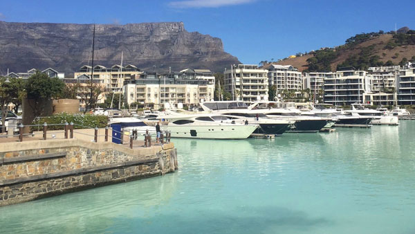
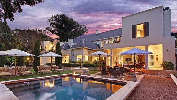
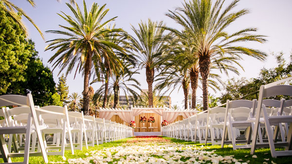
VIEW TOURS & SAFARIS
When you visit South Africa, travel across a golden country that has everything to offer its visitors – vast empty spaces, wilderness, glorious beaches, dramatic scenery, and scorched plains. It is a country where two oceans – the Atlantic and the Indian – meet and converge to provide a spectacular coastline, a country so rich in soil that it’s fine is a protected element, and yet it still houses one of the most inhospitable deserts on earth, the Kalahari.